Long before European ships reached American shores, the continent buzzed with the movement of goods, ideas, and people along elaborate networks that would rival any modern highway system. You might imagine the Americas as isolated wilderness before 1492, but the reality tells a dramatically different story. Vast trade routes crisscrossed the landscape, connecting distant cultures through sophisticated systems that had flourished for thousands of years.
These ancient highways facilitated exchanges that spanned incredible distances. Imagine turquoise from New Mexico appearing in royal Maya tombs, or shells from the Gulf of Mexico adorning ceremonial garments in the Great Lakes region. The complexity and scope of these networks reveals civilizations far more interconnected than most people realize. So let’s dive in and explore the remarkable trade highways that bound together North America’s lost nations.
The Great Hopewell Exchange Network
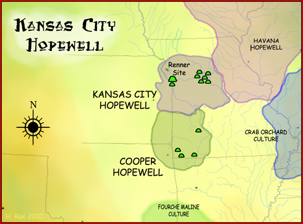
The Adena culture and the ensuing Hopewell tradition established continent-spanning trade and exchange networks, creating a widely dispersed set of populations connected by common trade routes that stretched from the northern shores of Lake Ontario south to the Crystal River Indian Mounds in modern-day Florida. Picture yourself standing in ancient Ohio around 200 BCE, watching caravans of traders carrying precious cargo across hundreds of miles of wilderness.
Within this vast network, peoples received materials from all over the territory of what now comprises the mainland United States, including obsidian from the Rocky Mountains, mica from the Appalachian region, and marine shells from the Gulf Coast, with Hopewellian trade networks stretching to the Gulf of Mexico for sea shells, North Carolina’s Blue Ridge Mountains for mica, the Chesapeake Bay for fossil shark teeth, Michigan’s Isle Royale and Keweenaw Peninsula for copper, and Yellowstone for obsidian. Most of the items traded were exotic materials delivered to peoples living in major trading and manufacturing areas, where these people converted raw materials into products and exported them through local and regional exchange networks.
Chaco Canyon’s Southwestern Trade Empire
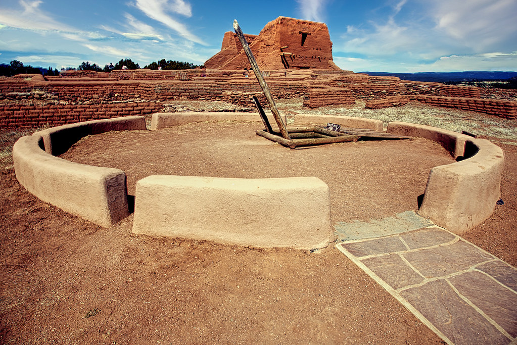
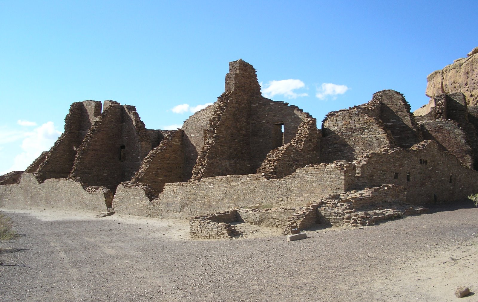
Chaco Canyon, centrally located in the San Juan Basin, was one of the most significant regional centers of the Ancestral Puebloan, especially during the period from A.D. 850 to 1250, with over 200,000 pieces of turquoise recovered throughout the canyon, extraordinary when compared with other archaeological sites throughout the American Southwest, clearly indicating that turquoise was a highly prized mineral and an important component in the economic and religious structures of this ancient culture.
Many commodities were transported into Chaco Canyon including chert, obsidian, ceramics, timber, and maize, as well as exotic goods such as shell, copper bells, macaws, cacao, and turquoise, with geochemical evidence showing multiple turquoise trade routes into Chaco Canyon linking turquoise from the San Juan Basin with deposits along the Rio Grande Rift and resource areas in Nevada and the Mojave region of southeastern California, supporting the proposal that the Virgin Puebloan may have played an important role in the movement of turquoise, shell, and salt to the San Juan Basin. The people of Chaco Canyon built a network of roads with clearly demarcated borders, ranging from eight to ten meters in width and adjusted to the treacherous topography, with stairways and ramps built into the roadway to maneuver over sandstone cliffs.
Mississippian River Networks
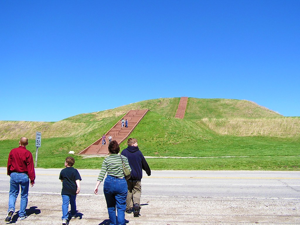
The Mississippian culture, which flourished from approximately 800 AD to 1600 AD, established significant trade routes throughout the southeastern United States, with the city of Cahokia, located near modern-day St. Louis, serving as a major trade hub and cultural epicenter whose central position allowed it to command a network of trade that stretched across various geographical regions. Other chiefdoms were constructed throughout the Southeast, and its trade networks reached to the Great Lakes and the Gulf of Mexico, with Cahokia at its peak, between the 12th and 13th centuries, being the most populous city in North America.
From the Gulf of Mexico, shells were transported, which were often used in the creation of intricate jewelry and ceremonial objects, while regions near the Great Lakes supplied copper, a vital material for creating tools and decorative items, evidenced by the copper artifacts unearthed by archaeologists. Think of Cahokia as the Chicago of its time, a bustling metropolis where goods from across the continent converged in massive plazas and markets.
Northern Woodland Trading Trails
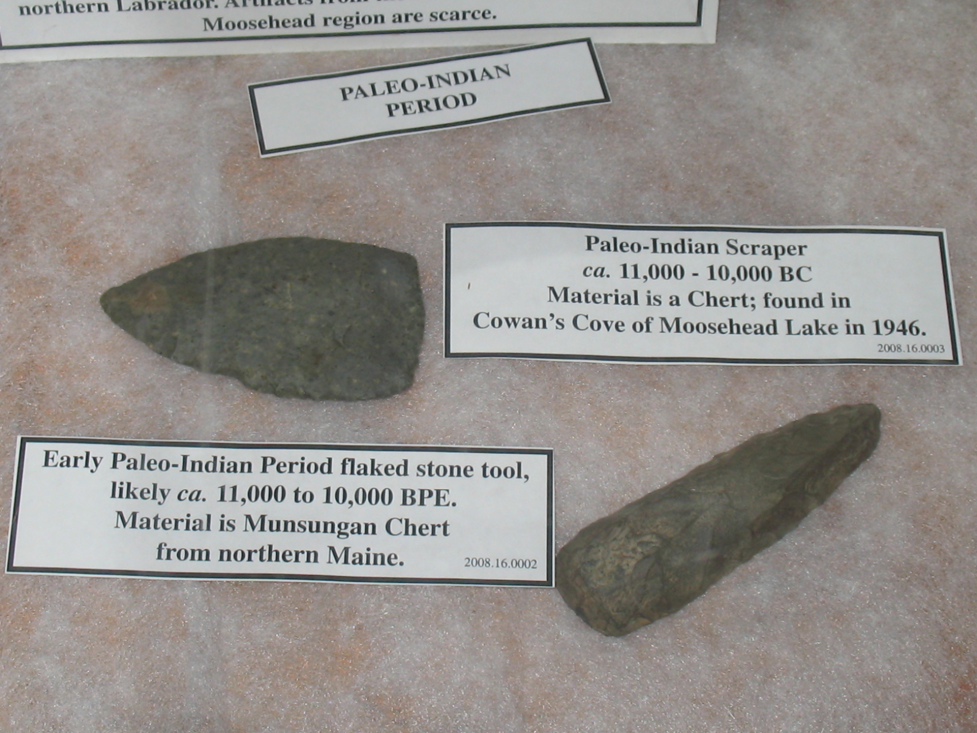
Ramah chert (found only on the coast of Labrador) artifacts have been discovered in the Maritimes, as far south as Maine, USA and as far west as Trois Rivières, Québec, indicating that the chert tools were traded for items unavailable in the harsh northern Labrador environment and vast travel and communication between geographically separate and culturally distinct groups. These northern routes defied the challenging geography, proving that necessity and ingenuity could overcome any obstacle.
The Oolichan Grease Trail is another example of an extensive trade network, with the oolichan, a Pacific coast fish found in the waters from Alaska south to northern California, being a valuable commodity traded extensively from the coast to inland communities along established trade routes, now known as “Grease Trails.” The topography in reality did not so much limit trade as it influenced routes and modes of transport, with pre-contact Peoples in what is now known as Canada having neither iron, wheels or large pack animals, so waterways directed which regions had the most expansive networks.
Mesoamerican Continental Connections
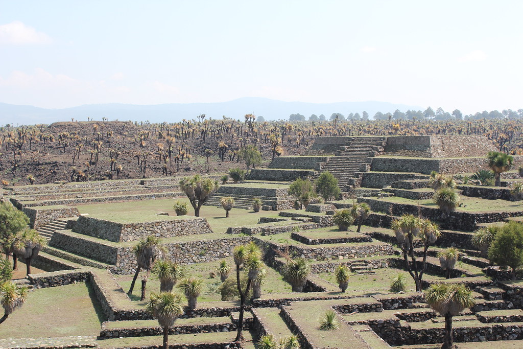
There is evidence of trade routes starting as far north as the Mexico Central Plateau, and going down to the Pacific coast, with these trade routes and cultural contacts extending as far as Central America, operating with various interruptions from pre-Olmec times and up to the Late Classical Period (600–900 CE). Cultures from Central Mexico south to Costa Rica were captivated by the lustrous green jadeite stone that is believed to have come from a single source in the Motagua Valley of Guatemala, with the ancient Olmec who thrived along the Gulf Coast of Mexico between 1500 BC and 400 BC first mining the stone and creating remarkable figurines, masks and ear ornaments, while around the same time, the Maya, in present-day Belize and Guatemala, created beads and plaques with images of leaders and deities.
The civilizations in present-day Mexico and Central America, known as the Mesoamerican cultures, significantly influenced the trade routes stretching into North America, primarily due to their advanced agricultural systems and developed urban centers, which facilitated organized commerce, with the vibrant Mesoamerican trade system being crucial in dispersing goods across a wide area. Cacao, the source of chocolate, was not only used as a food but also served as currency in various Mesoamerican cultures, while turquoise, treasured for its beauty, was traded extensively from mines in the American Southwest.
Transportation Methods and Infrastructure
On land, goods were often transported on foot, and travois, which are wooden frames used to carry loads, were employed, carried by people or sometimes dogs, reflecting an adaptation to the environment that increased the capacity to transport goods across challenging terrains, underscoring the ingenuity and resilience in addressing logistical challenges prominent in the pre-European Americas. Imagine the dedication required to carry heavy copper ingots from the Great Lakes to the Gulf Coast on foot across hundreds of miles.
Staircases leading out of the canyon allowed people to climb the mesas and access a vast network of roads that connected places across great distances, such as Great Houses in the wider region. The road system that connects it to distant outlier pueblos is unique, with nothing like it existing elsewhere in North America. The land today bears remnants of a system of 30-foot-wide roads radiating outward from Chaco Canyon, as well as extensive ruins, artifacts and even lunar calendars etched into boulders.
Exotic Goods and Sacred Materials
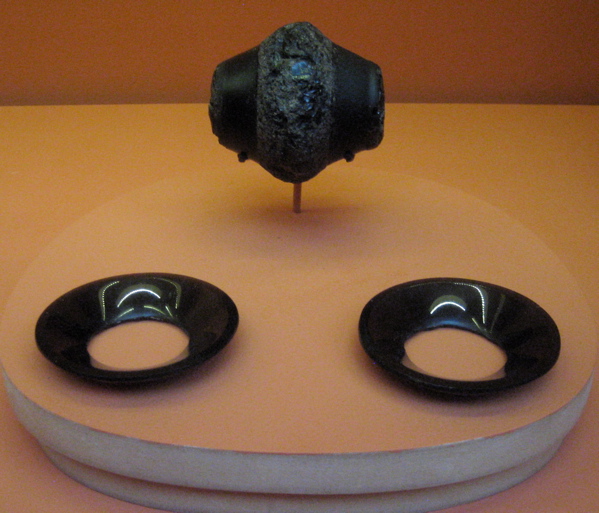
Obsidian, a volcanic glass crucial for making sharp tools and ceremonial objects, moved along these networks connecting cultures far from its geological origins, with these commodities being exchanged in vast marketplaces, indicating a complex socio-economic structure that connected diverse cultures through trade. Many of the mounds contain various types of human burials, some containing precious grave goods such as ornaments of copper, mica and obsidian imported from hundreds of miles away, with some graves lined with woven mats, mica (a mineral consisting of thin glassy sheets), or stones, and the Hopewell producing artwork in a greater variety and with more exotic materials than their predecessors the Adena, crafting grizzly bear teeth, fresh water pearls, sea shells, sharks’ teeth, copper, and small quantities of silver as elegant pieces.
Although archeologists do not know the exact meanings these materials had for the Hopewell, it appears that these materials were considered powerful, with the intrinsic properties (or powers) of copper, mica, obsidian, and shell to the Hopewell warranting their difficult and dangerous retrieval, and once these materials reached the Hopewell heartland, they were carefully kept in ceremonial and ritual areas. You can almost feel the reverence these ancient peoples held for materials that traveled such tremendous distances.
The Collapse and Legacy of Ancient Trade

Around 500 AD, the Hopewell tradition began to decline, and mound-building ceased, with villages of the Late Woodland period shifting to larger communities, often fortified with palisade walls and ditches, possibly as a response to increased warfare, and as the trade routes diminished in importance, the network that had connected people to the Hopewell traditions gradually dissolved. Chaco Canyon flourished from AD 850 to 1250 when drought apparently led the Ancestral Puebloans to abandon the region, moving away and settling to the west and to the south, becoming part of the modern Pueblo people of the Southwest United States.
Unfortunately, the conquest of the Americas disrupted the trade network, and nation-to-nation trade among indigenous people ceased, making it very evident that all the roads from the historic pre-Columbian trade network led to major centers, but the conquest of the Americas disrupted the trade network, and nation-to-nation trade among indigenous people ceased. Cross-boundary movements were frequent and ordinary in the pre-Columbian past, with the examples showing that these routes were important for connecting diverse communities in Central America to each other and to regions north and south.
Conclusion
The ancient trade networks of pre-Columbian North America reveal a continent far more sophisticated and interconnected than popular imagination suggests. These highways carried more than goods across thousands of miles. They transported ideas, technologies, and cultural practices that enriched civilizations from the Arctic to Central America. The scale and complexity of these networks rival modern transportation systems in their organizational achievement.
Understanding the pre-Columbian exchange network through archaeology offers insights into the economic, social, and cultural dynamics of ancient American civilizations, underscoring the importance of trade routes in fostering cultural exchange and economic development, revealing a rich tapestry of interaction that shaped the history of the Americas. The legacy of these lost trade highways continues to inform our understanding of human achievement and cooperation. What aspects of these ancient networks do you think could inspire modern approaches to global trade? Tell us in the comments.