The Mesozoic Era (252-66 million years ago) was a time of dramatic global change, with the supercontinent Pangaea breaking apart, dramatic shifts in climate, and the reign of dinosaurs on land. Less visible but equally significant were the remarkable fluctuations in global sea levels during this period. Ocean waters advanced and retreated across continental margins throughout the Triassic, Jurassic, and Cretaceous periods, creating and destroying shallow seas, transforming ecosystems, and leaving behind a complex geological record. These ancient sea level changes, driven by various geological and climatic factors, provide valuable insights into Earth’s dynamic systems and offer important context for understanding modern sea level rise.
The Beginning: Triassic Period Sea Levels

The Mesozoic Era began with the Triassic Period (252-201 million years ago), emerging from the aftermath of the devastating Permian-Triassic extinction event. During the Early Triassic, global sea levels were relatively low, a continuation of conditions from the late Paleozoic Era. The newly formed supercontinent Pangaea created a vastly different oceanic configuration than today’s world, with the massive Panthalassa Ocean surrounding the landmass and the wedge-shaped Tethys Sea cutting into its eastern margin. Sea levels began a slow but steady rise as the Triassic progressed, particularly during the Middle and Late Triassic periods. This gradual transgression (advance of seas onto land) was primarily driven by increased seafloor spreading rates that reduced the volume of ocean basins, displacing water onto continental margins. By the Late Triassic, many coastal areas experienced flooding that would set the stage for more dramatic changes to come.
Measuring Ancient Sea Levels: Methods and Challenges

Determining sea levels from tens or hundreds of millions of years ago presents significant scientific challenges that require multiple lines of evidence. Geologists primarily rely on sedimentary rock sequences that record ancient shorelines, with particular attention to the boundaries between marine and non-marine deposits. Distinctive features like wave-cut terraces, beach deposits, barrier islands, and tidal flats help identify ancient shorelines in the rock record. Paleontologists contribute by identifying marine versus terrestrial fossils, with microfossils like foraminifera being especially useful indicators of water depth. More challenging is accounting for subsequent geological processes that have affected these ancient shorelines, including tectonic uplift, subsidence, and isostatic rebound. Researchers must correct for these factors to reconstruct true eustatic (global) sea level changes versus local relative changes. Modern techniques, including seismic stratigraphy, sequence stratigraphy, and computer modeling, have greatly improved our ability to reconstruct Mesozoic sea level fluctuations despite these inherent difficulties.
The Jurassic Transgression

The Jurassic Period (201-145 million years ago) witnessed one of the most significant marine transgressions of the Mesozoic Era. Following a brief sea level drop at the Triassic-Jurassic boundary, ocean waters began a substantial and prolonged advance onto continental shelves worldwide. By the Middle Jurassic, sea levels had risen approximately 50-100 meters above present-day levels, creating extensive shallow seaways across many continental regions. This transgression reached a notable peak during the Oxfordian and Kimmeridgian stages of the Late Jurassic, when nearly 40% of present-day continental areas were submerged. In North America, the advancing waters created the Sundance Sea, which covered parts of Wyoming, Montana, and adjacent areas. Similarly, in Europe, shallow epicontinental seas covered much of what is now England, France, and Germany, creating ideal conditions for the deposition of the commercially important Jurassic limestone formations. These extensive shallow seas dramatically altered global ecosystems, providing new habitats for marine life and influencing terrestrial environments and climate patterns.
Pangaea’s Breakup and Its Effect on Ocean Basins

The breakup of the supercontinent Pangaea, which began in the Late Triassic and accelerated throughout the Jurassic, fundamentally altered the configuration of Earth’s ocean basins and significantly influenced sea levels. As tectonic forces pulled the continental crust apart, new mid-ocean ridges formed where magma welled up from the mantle to create new oceanic crust. These spreading centers, being thermally elevated, displaced ocean water onto continental margins. The initial rifting between North America and Africa created the embryonic central Atlantic Ocean, while the separation of the southern continents began to form the early Indian Ocean. This intensive seafloor spreading increased the total length of mid-ocean ridges globally, reducing the average depth of ocean basins. Geologists estimate that during peak spreading phases, this tectonic factor alone could have contributed 100-200 meters to global sea level rise. Additionally, as Pangaea fragmented, the resulting smaller continents experienced greater erosion along their newly created margins, further modifying coastal topography and relative sea levels around these emerging landmasses.
The Cretaceous Peak: Highest Sea Levels of the Phanerozoic

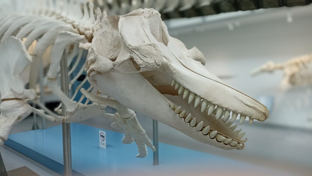
The Cretaceous Period (145-66 million years ago) witnessed the most extreme high-stand of sea level in the past 540 million years, with global ocean levels reaching 250-300 meters above present day during the Late Cretaceous (approximately 85-80 million years ago). This extraordinary marine transgression resulted in flooding of nearly 40% of Earth’s continental areas, creating vast inland seaways across multiple continents. North America was divided by the Western Interior Seaway, a massive body of water extending from the Gulf of Mexico to the Arctic Ocean, effectively splitting the continent in two. Similarly, the Turgai Sea flooded much of eastern Europe and western Asia, while large portions of Australia, South America, and Africa experienced extensive coastal flooding. This period of extraordinarily high sea levels was driven by a perfect storm of factors: rapid seafloor spreading, the complete absence of polar ice caps in Earth’s greenhouse climate, and the displacement of ocean water by enormous submarine volcanic provinces like the Ontong Java Plateau. The resulting shallow seas created unique ecosystems that supported incredible marine biodiversity, including mosasaurs, plesiosaurs, and diverse invertebrate communities.
The Role of Climate in Mesozoic Sea Level Changes
The Mesozoic Era was predominantly characterized by a greenhouse climate significantly warmer than today’s world, which played a crucial role in sea level dynamics. Polar regions during this time were entirely free of permanent ice, with evidence of temperate forests growing at high latitudes in both hemispheres. This absence of continental ice sheets removed a major mechanism of sea level change present in our modern world—the sequestration and release of water through glacial cycles. Without ice caps, the baseline sea level was naturally higher throughout the Mesozoic. Furthermore, the greenhouse climate caused thermal expansion of ocean waters, potentially adding 5-10 meters to global sea levels during the warmest intervals. The Mesozoic wasn’t uniformly warm, however, with several cooling events causing temporary sea level drops, particularly at the Triassic-Jurassic boundary and during brief intervals in the Early Cretaceous. Evidence from oxygen isotope ratios in marine fossils suggests these cooler phases may have seen limited polar ice formation, though not at the scale of modern ice sheets. The connection between climate and sea level throughout the Mesozoic demonstrates the sensitivity of Earth’s ocean systems to global temperature changes, a relationship that remains critically important in our warming world today.
The Western Interior Seaway: North America’s Mesozoic Sea

The Western Interior Seaway stands as perhaps the most dramatic example of Mesozoic sea level rise reshaping continental geography. At its maximum extent during the Late Cretaceous (around 85-80 million years ago), this shallow epicontinental sea stretched over 3,000 miles from the Arctic Ocean to the Gulf of Mexico, with a width of up to 1,000 miles in places. The seaway effectively divided North America into two landmasses: Laramidia to the west and Appalachia to the east. With an average depth of less than 200 meters, this shallow, warm sea created a unique marine ecosystem that supported a remarkable diversity of life, including massive marine reptiles like mosasaurs and plesiosaurs, giant sea turtles, ammonites, and various fish species. The seaway’s sediments preserved exceptionally complete fossil records, particularly in formations like the Niobrara Chalk in Kansas and the Pierre Shale across the Great Plains region. These sedimentary deposits also created economically important resources, including significant petroleum and natural gas reserves that would be discovered millions of years later. The Western Interior Seaway began its gradual retreat in the late Cretaceous as sea levels slowly declined and the Laramide Orogeny (mountain-building episode) uplifted the western regions, finally disappearing completely by the early Paleogene Period.
Cycles of Transgression and Regression

Throughout the Mesozoic Era, sea levels didn’t simply rise steadily but instead followed complex patterns of advance (transgression) and retreat (regression) across continental margins. These cycles occurred at multiple timescales, from major era-spanning trends to shorter oscillations lasting just a few million years. The longest-term pattern showed an overall rising trend from the Early Triassic through the Late Cretaceous, followed by a general decline into the Cenozoic Era. Superimposed on this were second-order cycles lasting 10-30 million years, which geologists have correlated with major tectonic episodes and changes in mid-ocean ridge volumes. Even shorter third-order cycles, spanning 1-5 million years, appear throughout the Mesozoic rock record and likely reflect regional tectonic influences or shorter-term climate oscillations. These cyclic patterns created sequences of marine sedimentary rocks that alternate with terrestrial deposits, formations that geologists call “cyclothems.” The alternation between marine and terrestrial environments had profound effects on evolution and ecology, creating selective pressures that drove adaptation in many lineages. Understanding these cycles has practical implications as well, as the resulting sedimentary sequences often form important petroleum systems, with organic-rich marine shales serving as source rocks and porous sandstones as reservoirs.
Biological Consequences of Changing Sea Levels

The dramatic sea level fluctuations of the Mesozoic Era profoundly influenced the evolution and distribution of life on Earth. Rising seas fragmented terrestrial habitats by creating new barriers between land areas, promoting allopatric speciation and regional endemism among land-dwelling organisms. The fossil record shows multiple examples of dinosaur lineages diverging as populations became isolated by advancing seaways. Simultaneously, marine transgressions created vast new shallow marine ecosystems that served as evolutionary cradles for diverse groups. The extensive continental shelves of the Jurassic and Cretaceous supported unprecedented radiations of marine reptiles, ammonites, rudist bivalves, and reef-building organisms. These shallow seas also provided critical nursery habitats for many marine species, enhancing overall marine biodiversity. Conversely, during regressive phases when sea levels fell, these same shallow marine ecosystems faced crisis conditions as habitats contracted, often leading to localized extinction events. The connection between sea level and biodiversity was particularly evident during the Late Cretaceous, when the exceptionally high sea levels corresponded with peak diversity of many marine groups, followed by selective extinctions during the subsequent regression. This historical relationship between sea level and biodiversity has important implications for understanding how modern marine ecosystems might respond to ongoing climate-driven sea level changes.
Chalk Deposits: Evidence of Cretaceous Seas

The Cretaceous Period derives its name from the Latin “creta,” meaning chalk, reflecting the extensive chalk deposits that formed during this time of exceptionally high sea levels. These distinctive white limestone formations, composed primarily of the microscopic calcite plates (coccoliths) of marine algae called coccolithophores, accumulated in the warm, shallow seas that covered much of Europe, parts of North America, and other continental regions. The White Cliffs of Dover in England stand as perhaps the most famous example, but similar deposits extend across Northern France, Denmark, and Germany in what geologists call the Anglo-Paris Basin. These chalk formations required specific conditions to form: clear, relatively shallow waters with minimal terrestrial sediment input and abundant microscopic marine life. The extraordinary thickness of many chalk deposits—often hundreds of meters—testifies to both the longevity and stability of these marine conditions and the incredibly productive plankton communities that thrived in these environments. Within these chalks, fossils of larger creatures, including mosasaurs, plesiosaurs, marine turtles, ammonites, and various fish, provide a window into the rich ecosystems that flourished in these vanished seaways. The global distribution of these unique deposits represents compelling physical evidence of just how extensively oceans advanced across continental regions during peak Cretaceous sea levels.
The Late Cretaceous Regression

After reaching their zenith during the Late Cretaceous, global sea levels began a significant regression during the final 15 million years of the Mesozoic Era. By the Maastrichtian stage (72-66 million years ago), ocean levels had dropped by approximately 100-150 meters from their Campanian peak, though they remained well above present-day levels. This marine regression exposed vast areas of formerly submerged continental shelves, reconnecting previously isolated landmasses and dramatically altering coastal ecosystems worldwide. The Western Interior Seaway of North America gradually retreated southward, eventually separating into northern and southern remnants before disappearing entirely. This sea level fall resulted from a combination of decreased seafloor spreading rates, regional tectonic uplift, and possible climate cooling with limited polar ice formation. The ecological consequences were profound, with many shallow marine species experiencing habitat loss and range restrictions. Terrestrial environments expanded, creating new migration corridors and habitats for dinosaurs and other land animals during the final stages of the Cretaceous. This regression created an environmental backdrop of already-stressed ecosystems even before the asteroid impact that would mark the end of the Mesozoic Era, possibly contributing to the severity of the end-Cretaceous mass extinction.
Modern Implications and Lessons from Mesozoic Sea Level Changes

The dramatic sea level fluctuations of the Mesozoic Era provide valuable context for understanding our changing planet today. While modern sea level rise occurs at rates far exceeding those typical of the Mesozoic, studying these ancient changes helps scientists build better models of how Earth systems respond to varying ocean levels. The extensive marine sedimentary record from Mesozoic seaways provides crucial data on how ecosystems adapt to—or fail to adapt to—changing coastlines and habitats. This historical perspective is particularly relevant as modern climate change drives current sea level rise through both melting ice sheets and thermal expansion of warming oceans. The Mesozoic record vividly illustrates how substantially different Earth can look under high-stand conditions, with drastically altered coastlines and continental geographies. Unlike the Mesozoic, however, today’s coastlines host billions of people, critical infrastructure, and economic assets that make sea level rise a pressing societal challenge. Additionally, while Mesozoic sea level changes occurred over millions of years, giving ecosystems time to adapt, current changes are happening at unprecedented rates that may exceed the adaptive capacity of many natural systems. By studying how ancient life and ecosystems responded to changing sea levels, scientists gain insights that help predict and potentially mitigate the impacts of our current sea level challenges.
Conclusion
The Mesozoic Era witnessed extraordinary fluctuations in global sea levels that transformed Earth’s surface. From the relatively low levels of the Early Triassic to the unprecedented highs of the Late Cretaceous and subsequent regression, these changes reshaped continental margins, created and destroyed vast inland seas, and profoundly influenced the evolution of both marine and terrestrial life. Driven by the dynamic interplay of tectonic forces, climate conditions, and oceanic processes, Mesozoic sea levels tell a story of an Earth dramatically different from our own—a planet where shallow seas covered vast portions of what are now continents, supporting unique ecosystems long since vanished. As we face the challenges of human-induced climate change and accelerating sea level rise, the lessons from Earth’s Mesozoic past provide valuable perspective on the dynamism of our planet’s oceans and their profound influence on life and landscapes through deep time.