The heart of North America once harbored vast prehistoric seas that divided the continent into separate landmasses. These ancient inland waterways, which existed during various geological periods, fundamentally shaped the continent we know today. From the Western Interior Seaway of the Cretaceous period to earlier Paleozoic seas, these massive bodies of water created unique ecosystems, deposited rich sedimentary layers, and left behind a remarkable geological legacy. The story of these inland seas reveals how North America’s geography has dramatically transformed over millions of years, influencing everything from fossil formation to modern topography and natural resource distribution.
The Western Interior Seaway: North America’s Great Divide
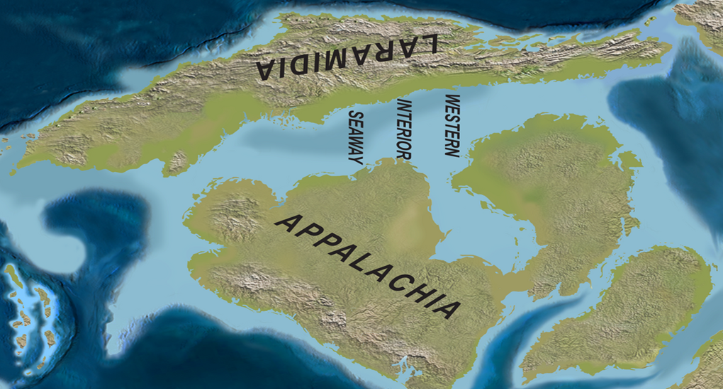
During the mid to late Cretaceous period, approximately 100 to 66 million years ago, North America looked dramatically different than it does today. A vast inland sea known as the Western Interior Seaway stretched from the Arctic Ocean to the Gulf of Mexico, effectively splitting the continent into two landmasses. This shallow marine environment, sometimes reaching depths of only a few hundred feet, covered what is now the Great Plains and much of the central lowlands of the United States and Canada.
At its maximum extent, this seaway was approximately 2,000 miles long and up to 600 miles wide, creating a marine corridor through the heart of North America. The western shore roughly followed the early Rocky Mountains, while the eastern coastline tracked along what would become the Appalachian highlands, creating two distinct landmasses often referred to as Laramidia to the west and Appalachia to the east.
Geological Origins of the Inland Seas

The formation of North America’s inland seas was primarily driven by global tectonic processes and changes in sea level that occurred over millions of years. During the Cretaceous period, Earth experienced a greenhouse climate with no polar ice caps, resulting in sea levels significantly higher than today – by some estimates up to 100 meters higher. Simultaneously, tectonic activity along western North America created the early Rocky Mountains through a process called the Sevier Orogeny, where the oceanic Farallon Plate subducted beneath the North American continental plate.
This mountain-building process created a foreland basin – a depression in front of the mountain range – that allowed seawater to flood in from both the Arctic Ocean and the Gulf of Mexico when sea levels were high enough. The weight of the growing mountains caused the adjacent continental crust to flex downward, creating a broad, shallow depression that became the seaway. These geological processes worked in concert with global sea-level fluctuations to repeatedly flood and drain the continental interior over millions of years.
Life in the Ancient Seaway
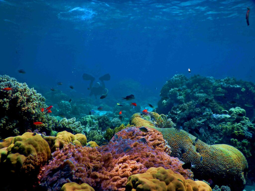
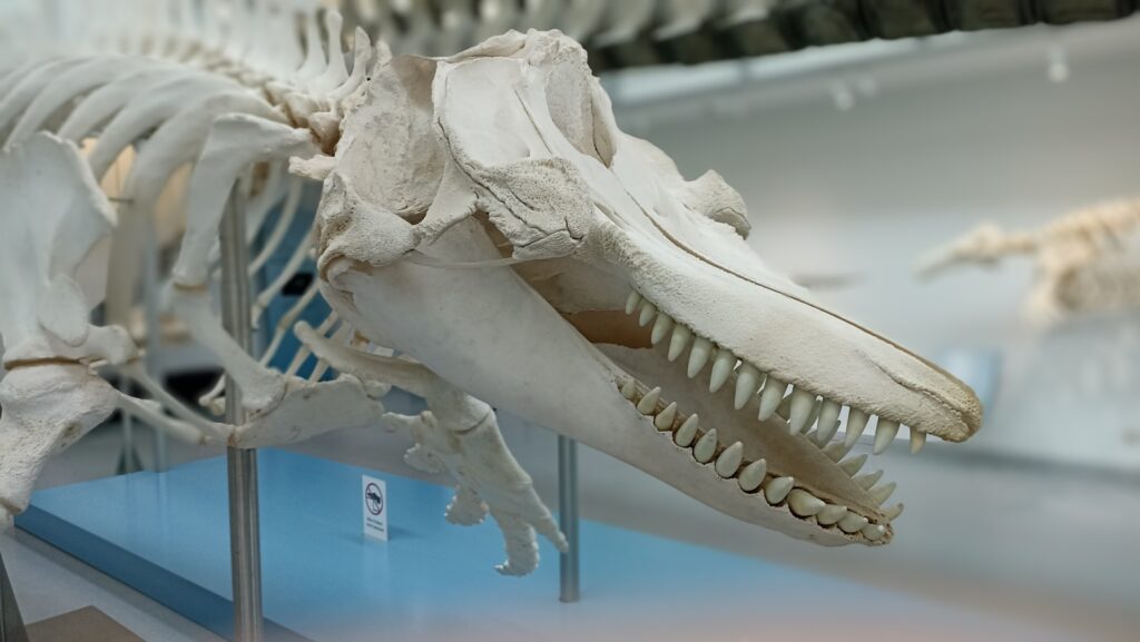
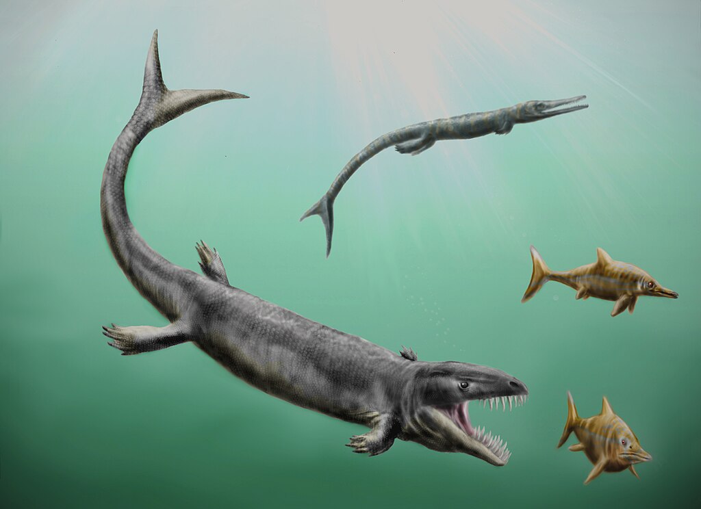
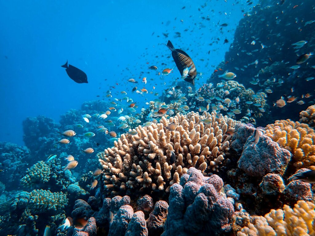
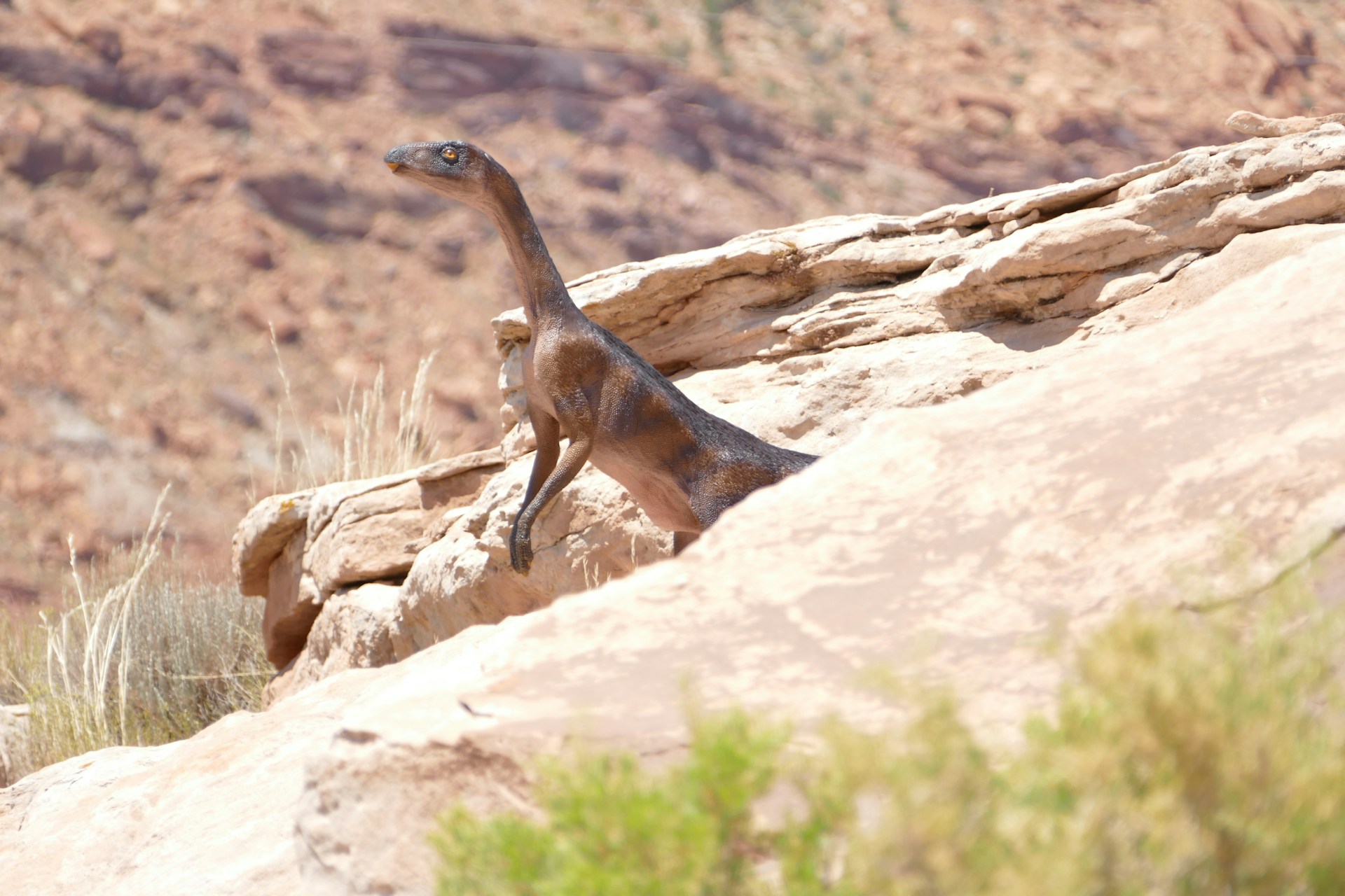
The Western Interior Seaway teemed with marine life that would seem both familiar and alien to modern observers. Massive marine reptiles ruled these waters, including mosasaurs – predatory lizards that could grow up to 50 feet long – and plesiosaurs with their characteristic long necks and paddle-like limbs. Giant sea turtles like Archelon, measuring up to 13 feet across, swam alongside ammonites, spiral-shelled relatives of today’s octopuses and squids. Enormous fish species such as Xiphactinus, which could reach lengths of 20 feet, hunted in these waters, while countless smaller fish, sharks, and rays completed the complex food web.
The seaway was also home to microscopic plankton, including diatoms and foraminifera, whose countless shells gradually accumulated on the seafloor. Near the shorelines, primitive flowering plants were beginning to diversify, while various dinosaur species inhabited the surrounding landmasses of Laramidia and Appalachia, occasionally leaving their remains to be swept into the sea and preserved as fossils.
The Sundance Sea: A Jurassic Predecessor
Before the Western Interior Seaway dominated the landscape, an earlier inland sea known as the Sundance Sea covered portions of western North America during the Middle to Late Jurassic period, approximately 174 to 155 million years ago. This marine incursion extended from what is now southern Alaska through western Canada and into the western United States, covering portions of Montana, Wyoming, Utah, Idaho, and South Dakota. The Sundance Sea was characterized by relatively shallow, warm waters that supported a diverse ecosystem including ammonites, belemnites, and various marine reptiles, including ichthyosaurs and plesiosaurs.
Unlike the later and more extensive Western Interior Seaway, the Sundance Sea did not completely divide the continent but rather flooded the western interior region. Evidence of this ancient sea can be found in the Sundance Formation, a sequence of sedimentary rocks composed of sandstones, limestones, and shales that contain abundant marine fossils, including well-preserved specimens of Jurassic marine invertebrates that help paleontologists reconstruct this ancient marine environment.
Paleozoic Seas and the Formation of Coal Deposits
Long before the Mesozoic inland seas, North America experienced numerous marine transgressions during the Paleozoic Era (542-251 million years ago), which profoundly influenced the continent’s geology and future energy resources. During the Carboniferous period (359-299 million years ago), extensive shallow seas repeatedly covered large portions of the continent, creating conditions perfect for the formation of vast swamps and peat bogs in coastal areas.
These swampy environments supported lush forests of primitive plants, including massive tree ferns, scale trees, and giant horsetails that would eventually transform into the coal deposits that fueled the Industrial Revolution. When these plants died, they sank into oxygen-poor water where decomposition was limited, allowing organic material to accumulate as peat.
Over millions of years, as these areas were buried under sediments from later marine transgressions, heat and pressure transformed the peat into coal. The oscillation between marine and terrestrial environments created the characteristic cyclical patterns of coal, shale, and limestone seen in many Paleozoic rock formations across the eastern and central United States, particularly in the Appalachian Basin and Illinois Basin.
The Retreat of the Waters

The Western Interior Seaway began its gradual retreat during the late Cretaceous period, approximately 70 million years ago, driven by a combination of geological processes that fundamentally reshaped North America. The Laramide Orogeny, a major mountain-building event that began around 70-80 million years ago, intensified uplift in western North America, causing the land to rise and the seaway to slowly drain. This tectonic activity, which would eventually form the modern Rocky Mountains, created a steeper gradient from west to east, facilitating the eastward drainage of the seaway’s waters. Simultaneously, global sea levels began to drop as Earth’s climate gradually cooled, further accelerating the seaway’s regression.
By approximately 66 million years ago, around the time of the Cretaceous-Paleogene extinction event that eliminated the dinosaurs, the once-mighty seaway had largely withdrawn, leaving behind only isolated bodies of water in the lowest-lying areas. The final remnants of these seas disappeared in the early Paleocene, completing North America’s transformation from a divided continent to a single landmass, though the geological legacy of the seaway would remain permanently etched in the landscape.
Geological Legacy: Sedimentary Deposits
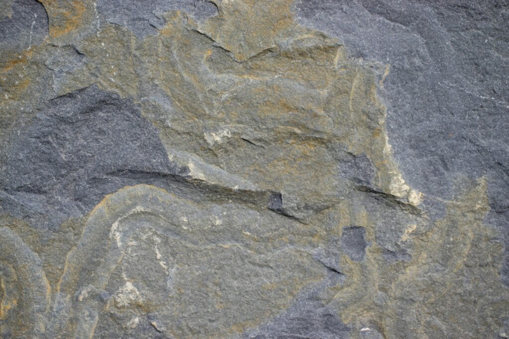
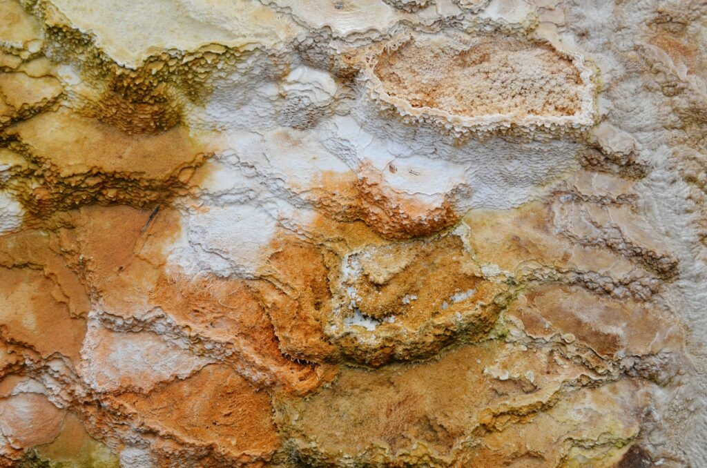
The ancient inland seas left behind extensive sedimentary deposits that tell the story of North America’s geological past in remarkable detail. As these shallow seas existed for millions of years, layer upon layer of sediment accumulated on their floors – fine muds, sands, and the calcium carbonate remains of countless marine organisms. These sediments eventually compacted and lithified into the sedimentary rocks that now underlie much of central North America. The Western Interior Seaway, in particular, left behind vast formations of shale, limestone, and sandstone, including the Pierre Shale, which extends from New Mexico to Manitoba and reaches thicknesses of up to 700 meters in some locations.
These rocks preserve not only the physical record of the seaway’s existence but also the chemical signatures of ancient ocean conditions, allowing geologists to reconstruct water temperatures, salinity levels, and oxygen content from millions of years ago. The cyclic nature of many of these deposits – alternating between marine and terrestrial sediments – reveals how sea levels fluctuated over time, repeatedly flooding and draining the continental interior in response to global climate changes and regional tectonic activity.
The Fossil Record: A Window to Ancient Ecosystems
The sedimentary rocks deposited by North America’s inland seas preserve one of the world’s most remarkable fossil records, offering an unparalleled window into ancient marine ecosystems. The Western Interior Seaway, in particular, has yielded exceptional fossil discoveries, including numerous complete skeletons of marine reptiles such as mosasaurs, plesiosaurs, and sea turtles.
In Kansas, the Niobrara Formation has produced thousands of spectacular specimens, including the famous “fish within a fish” – a 13-foot Xiphactinus that died after swallowing a 6-foot Gillicus whole. The Pierre Shale formation has revealed diverse ammonite assemblages that help paleontologists track evolutionary changes and establish relative dating of rock layers.
Perhaps most scientifically valuable are the microscopic fossils – the foraminifera, diatoms, and other microfossils that accumulated in astronomical numbers and now provide crucial data for paleoclimate research. These tiny organisms are particularly sensitive to environmental conditions, making them excellent indicators of ancient water temperatures, nutrient levels, and other ecological parameters that help scientists reconstruct the Cretaceous world in remarkable detail.
Natural Resources: Oil, Gas, and Mineral Wealth
The legacy of North America’s inland seas extends far beyond scientific interest – it directly impacts the continent’s economic landscape through vast deposits of natural resources. The organic-rich muds that accumulated in these ancient seaways, particularly during times of low oxygen conditions, eventually transformed into the source rocks for much of North America’s petroleum reserves. The Western Interior Seaway’s deposits formed major oil and gas reservoirs now found throughout the Western Canadian Sedimentary Basin, the Williston Basin, and the Denver-Julesburg Basin.
The Pierre Shale alone contains an estimated 6 billion barrels of oil and 19 trillion cubic feet of natural gas. Beyond hydrocarbons, these ancient marine deposits yielded valuable mineral resources, including phosphates used in fertilizers, bentonite clay utilized in everything from cat litter to drilling muds, and potash minerals essential for agricultural fertilizers.
Even the chalk deposits formed from the countless shells of microscopic marine organisms have economic value, with the famous Niobrara Chalk being quarried for use in cement production and other industrial applications. This natural resource wealth, directly tied to the continent’s geological history, has profoundly shaped patterns of human settlement and economic development across the Great Plains region.
Modern Landforms Shaped by Ancient Seas
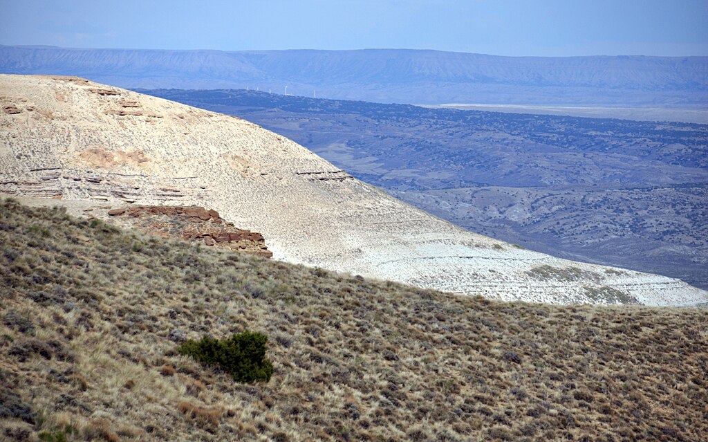
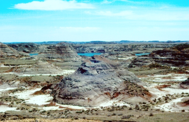
The topography of central North America bears the unmistakable imprint of its submerged past, with many modern landforms directly attributable to the ancient inland seas. The vast, relatively flat expanse of the Great Plains owes its character to the sedimentary layers deposited on the floor of the Western Interior Seaway, which created a generally level surface as the waters receded. More dramatic features include the badlands of South Dakota and the Black Hills, where erosion has carved intricate landscapes from the ancient seabed deposits.
In Kansas and neighboring states, chalk formations like Monument Rocks and Castle Rock rise dramatically from the surrounding plains, composed entirely of microscopic marine organisms that accumulated on the Cretaceous seafloor. Further north, the pothole lakes of the Prairie Pothole Region—critical waterfowl habitat stretching from Iowa to Alberta—occupy depressions formed during the final retreat of the inland seas and subsequent glacial activity. Even major river systems like the Missouri and Mississippi follow courses partly determined by the ancient topography of the seaway, their drainage patterns influenced by the subtle gradients established as the waters withdrew eastward millions of years ago.
Hudson Bay: A Modern Remnant?

While not directly connected to the Western Interior Seaway, Hudson Bay represents a modern example of how inland seas can influence continental geography. This massive bay, covering approximately 470,000 square miles, penetrates deeply into the North American continent, creating a significant marine intrusion into the Canadian Shield. Unlike the ancient seaways that formed through tectonic activity and high global sea levels, Hudson Bay owes its existence primarily to glacial processes.
During the last ice age, the enormous weight of the Laurentide Ice Sheet depressed the Earth’s crust in the Hudson Bay region by hundreds of meters. When the ice melted approximately 8,000 years ago, seawater flooded the depressed basin, creating the inland sea we see today. Interestingly, Hudson Bay continues to undergo isostatic rebound—the gradual rising of the land as it recovers from the weight of the ice—at a rate of about 1.1 centimeters per year.
This ongoing process means the bay is actually shrinking, with new land emerging along its coastlines, demonstrating how dynamic the relationship between land and sea continues to be in North America, even if on a much smaller scale than the continent-dividing seaways of the Mesozoic era.
Climate Impact of the Ancient Seas
The presence of vast inland seas significantly influenced North America’s prehistoric climate patterns in ways that paleoclimatologists are still working to fully understand. During the Cretaceous period, the Western Interior Seaway acted as a massive heat reservoir, absorbing solar radiation and moderating temperatures across adjacent landmasses. Computer climate models suggest that the seaway created milder conditions throughout much of central North America, with reduced seasonal temperature extremes compared to today’s continental climate. The warm, shallow waters likely generated substantial evaporation, increasing atmospheric moisture and precipitation levels in regions that are relatively arid today.
This marine influence created humid, subtropical conditions that supported lush vegetation along the seaway’s margins, as evidenced by fossil plant assemblages found in contemporary rock formations. Ocean currents within the seaway transported warm waters northward from the Gulf of Mexico region, potentially allowing more tropical ecosystems to exist at higher latitudes than would otherwise be possible. The seaway also likely created unique weather patterns, including stronger coastal convergence zones and possibly more frequent and intense storm systems where warm seaway waters met cooler air masses from the northern regions, much like the storm-generating effects seen along modern coastlines.
The Legacy in Native American Culture
While the Western Interior Seaway vanished long before humans arrived in North America, its geological legacy influenced Native American cultures through the abundant fossils and unique landforms it left behind. Many Plains Indian tribes incorporated fossil marine creatures into their spiritual beliefs and origin stories, particularly the large vertebrate fossils that weathered out of exposed formations.
The Lakota, for instance, referred to ammonites as “Inyan cangleska” or “stone wheels,” while large marine reptile fossils were sometimes interpreted as the remains of water monsters. The distinctive chalk formations in Kansas and Nebraska, direct remnants of the seaway, served as important landmarks for various tribes and often featured in cultural narratives. Archaeological evidence shows that Native Americans collected fossilized shells and shark teeth, using them for tools, jewelry, and possibly ceremonial purposes.
The rich soils derived from marine sediments also contributed to the agricultural productivity of certain regions, supporting farming communities along river valleys where these deposits were prevalent. Even the natural springs and saline seeps that emerge from ancient seaway formations played roles in traditional medicine and salt-gathering practices, demonstrating how deeply the ancient seas’ influence permeated indigenous relationships with the landscape long after the waters had receded.
Future Research and Ongoing Discoveries

The ancient inland seas of North America continue to yield new scientific insights as researchers employ increasingly sophisticated technologies and interdisciplinary approaches. Advanced geochemical techniques now allow scientists to analyze isotope ratios in fossil shells and teeth, revealing precise data about water temperatures, salinity levels, and even seasonal variations in the ancient seaway.
High-resolution 3D seismic imaging permits geologists to map subsurface structures in unprecedented detail, identifying ancient shorelines, river deltas, and channel systems hidden beneath the modern landscape. Paleontologists regularly make breakthrough discoveries, including a 2019 find in North Dakota of fossils apparently deposited on the very day the Chicxulub meteorite struck Earth 66 million years ago, preserving fish with impact spherules in their gills.
Climate modelers continue refining simulations of how the Western Interior Seaway influenced continental weather patterns, contributing to our understanding of how future sea level changes might affect global climate. Molecular paleontology, a relatively new field, is revealing genetic information preserved in some exceptionally well-preserved fossils, potentially illuminating evolutionary relationships among ancient marine organisms. These ongoing investigations not only enhance our understanding of North America’s geological past