You live on a planet that has never stopped moving. Continents drift like slow-motion icebergs across a deep, swirling mantle, crashing together to form mountains and tearing apart to open oceans. When you hear names like Africa, Antarctica, India, or Australia, you probably think of them as separate and permanent. But if you rewind Earth’s clock hundreds of millions of years, those familiar outlines blur and lock together into something far stranger: a supercontinent called Gondwana.
Once, what you now know as the Southern Hemisphere was dominated by this gigantic landmass. It shaped global climate, steered the evolution of life, and laid down the raw materials that power modern economies. As you trace Gondwana’s story, you’re not just looking at a long-dead continent; you’re following the deep-time roots of the places you walk, the fossils in museums you visit, and even the coal, gas, and metals that run the lights above your head.
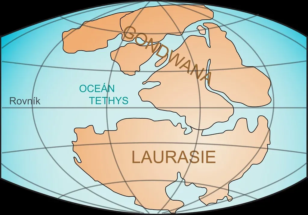
The Birth of Gondwana: A Continent Stitched from Collisions
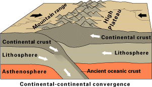
If you could time-travel back roughly six hundred million years, you would not see Gondwana appear in a single dramatic moment. Instead, you’d watch a slow, relentless stitching-together of smaller continents and blocks of crust, smashed into place by plate tectonics. Pieces that would later become South America, Africa, Arabia, India, Antarctica, and Australia collided over tens of millions of years, welding along massive mountain belts that once rivaled today’s Himalayas.
You can still trace those ancient collision zones in the rocks beneath your feet. If you stand in parts of Brazil and then compare the geology to rocks in West Africa, you find nearly identical ancient mountain belts, like matching scars on two bodies that were once joined. These scars tell you that Gondwana was not just an idea on a map; it was a physical reality built through crushing pressure, deep burial, and repeated cycles of subduction and uplift that reshaped Earth’s surface on a continental scale.
How You Know Gondwana Was Real: Fossils, Rocks, and Ice
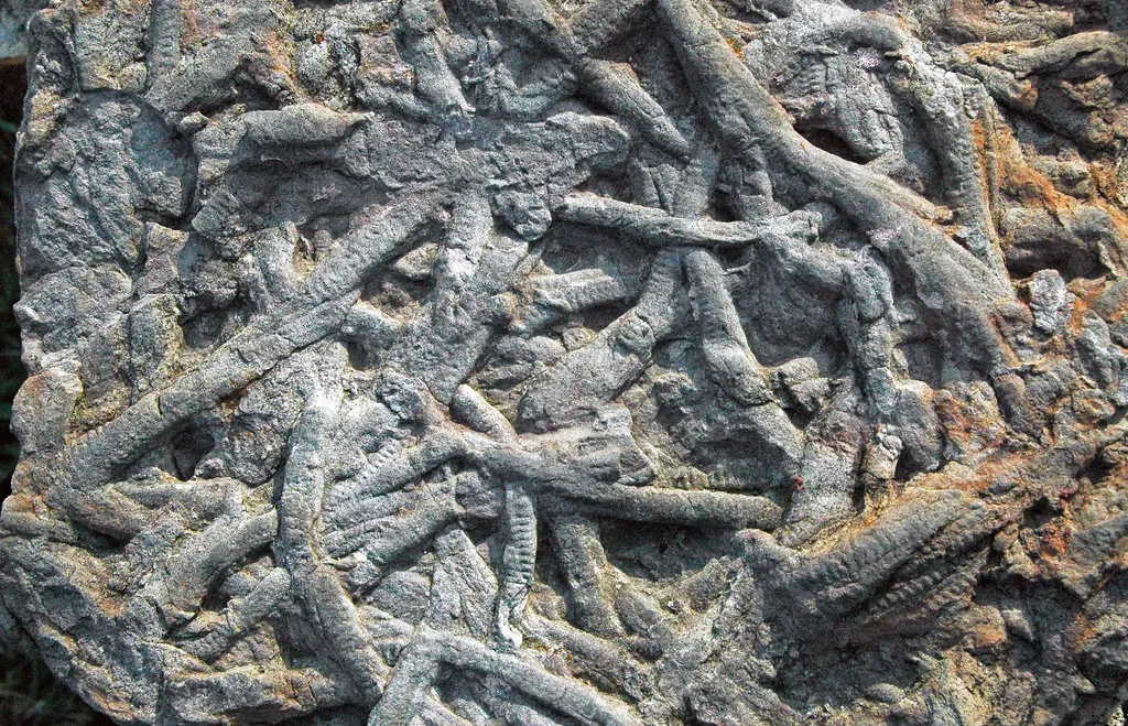
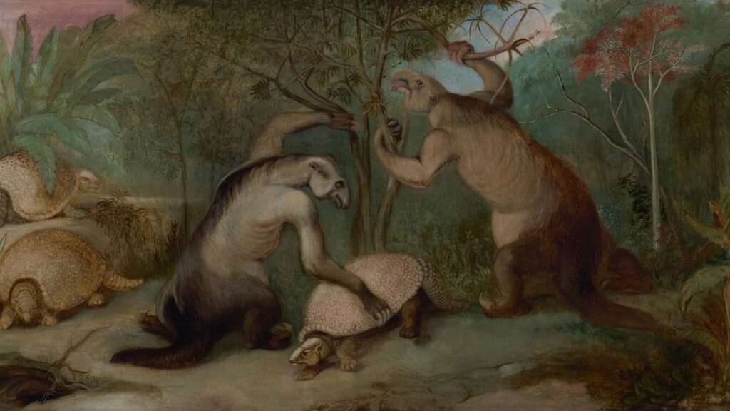
You might wonder how anyone can say with confidence that continents now thousands of kilometers apart once fit together. One of the most convincing clues comes from fossils. If you look at rocks in South Africa, India, South America, and Antarctica from the same age, you find the remains of the same extinct land animals and plants, including a small, stout reptile and distinctive seed ferns. These creatures could not have swum across wide oceans, so the only sensible explanation is that their habitats once formed a connected landmass.
Rocks and ancient climate evidence back you up further. In strata of the same age scattered across today’s Southern Hemisphere, you find telltale signs of massive glaciers that once scraped across the landscape in a single, unified ice sheet. The directions of these glacial scratches only make sense if you place the continents back into a Gondwana configuration centered over the South Pole. Layer by layer, you see that fossils, rock types, and even old ice trails line up perfectly when you reassemble the puzzle.
Life on Gondwana: Forests, Giants, and Mass Extinctions
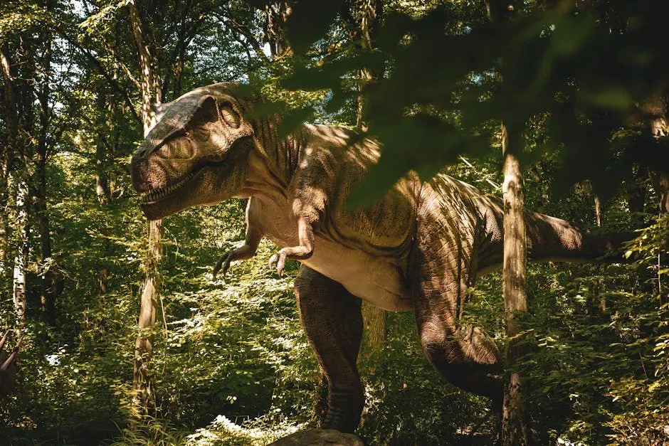
When you place yourself on Gondwana during the Paleozoic and Mesozoic eras, you’re walking through worlds that feel both alien and oddly familiar. Vast swampy forests, later turned into coal deposits, spread across low-lying regions. In some periods, thick stands of tree-like plants and early forests covered areas that are now dry or frozen, including parts of what you know as Antarctica. Amphibians, reptiles, and later dinosaurs roamed these landscapes, following river systems that no longer exist.
Gondwana sat at high latitudes for much of its history, which means life there had to cope with long, dark winters and seasonal extremes. Over time, you see unique plant groups adapt to cooler climates and seasonal light, laying the groundwork for the Southern Hemisphere floras you recognize today. But Gondwana was also shaken by crises: mass extinctions repeatedly reset the evolutionary clock. After each catastrophe, new groups of animals and plants radiated across Gondwana’s connected land, spreading from one part to another long before these regions drifted apart.
The Slow Breakup: From Supercontinent to Scattered Fragments
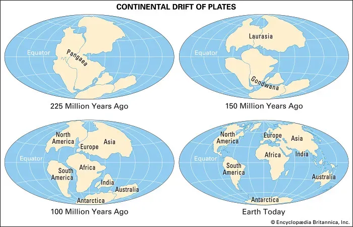
Supercontinents do not last forever, and Gondwana was no exception. Deep beneath your feet, heat builds up under large, thick plates, eventually weakening and bulging the crust. Around two hundred million years ago, this hidden tension began to tear Gondwana apart. First, great rift valleys opened, much like the modern East African Rift, and then those rifts flooded with magma to form new ocean crust. Bit by bit, Gondwana started to fracture into smaller continental pieces.
As the process continued, you see the South Atlantic begin to open, splitting South America from Africa. Later, India peeled away and raced northward, eventually crashing into Asia and driving up the Himalayas. Australia drifted off on its own path, and Antarctica settled over the South Pole. Every line on today’s global map that separates these continents from one another is, in a sense, a scar from Gondwana’s slow, grinding breakup – a record of deep-time forces still at work.
Gondwana Beneath Your Feet: Mountains, Minerals, and Energy
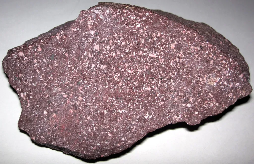
You might not realize it, but Gondwana still shapes your daily life in surprising ways. Many of the world’s richest mineral and energy deposits are tied to ancient processes that occurred when Gondwana was intact or when it began to break up. Thick coal seams in places like South Africa, India, and Australia formed from lush Gondwanan forests that were buried, compacted, and heated over immense spans of time. Later volcanic activity and movement of fluids through the crust concentrated metals such as gold, iron, and rare minerals along old fault zones and mountain belts.
Even the outlines of major mountain chains and plateaus tell you Gondwana’s story. If you walk through the Drakensberg in South Africa, trek the Andes in South America, or explore the ancient shield rocks of Western Australia, you’re moving through landscapes shaped by collisions and rifting linked to Gondwana’s assembly and breakup. Modern economies depend heavily on these ancient structures, from mining and groundwater resources to geothermal energy and fertile soils that developed on old bedrock.
Reading Deep Time: How You Reconstruct Lost Worlds
When you study Gondwana, you’re really learning how to read Earth’s long memory. You combine multiple lines of evidence: the shapes of continents, magnetic signals frozen in volcanic rocks that record past latitudes, matching rock layers and mountain belts, and the distribution of fossils across the globe. Each data set on its own might raise questions, but when you layer them together, a coherent picture emerges. You can literally spin the continents backward in computer models until they lock into the Gondwana arrangement that best fits all the clues.
This reconstruction work changes how you think about your own place in time. Instead of seeing continents as fixed, you start to view them like rafts on a restless mantle, occasionally gathering into supercontinents, then drifting apart again. By tracing Gondwana’s story, you learn to accept that coastlines, climates, and ecosystems you know now are temporary. In the very long run, even the most solid ground beneath you is just passing through.
Gondwana’s Legacy in Today’s Southern Hemisphere
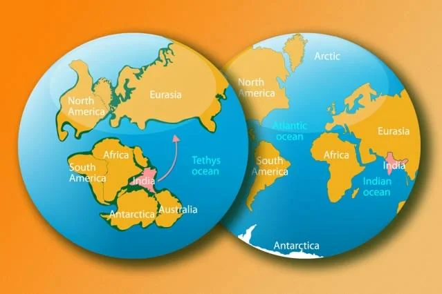
Look at a modern map and you can still see Gondwana’s fingerprints everywhere. Countries such as Brazil and Angola line up like broken edges of the same plate. The floras and faunas of South America, Africa, Australia, New Zealand, Madagascar, and Antarctica share deep evolutionary links because their ancestors once moved freely across Gondwana. When you notice unusual similarities between distant species – like certain birds, marsupials, or plant families – you are seeing echoes of migrations that happened long before humans appeared.
Even today’s climate patterns have roots in Gondwana’s breakup. As the Southern Ocean opened around Antarctica and that continent settled over the pole, powerful circumpolar currents formed and helped lock in the icy conditions you now associate with the frozen south. The isolation of Australia, South America, and Antarctica on separate plates steered ocean circulation and wind belts into new configurations. When you step outside and feel a warm tropical breeze or a frigid polar blast, you’re experiencing weather influenced by ancient tectonic choices made during Gondwana’s demise.
In the end, tracing the lost world of Gondwana is really about seeing your planet as a living, shifting system rather than a static backdrop. By following how this supercontinent formed, flourished, and fell apart, you connect the fossils in rocks, the ore in mines, the shape of coastlines, and even modern biodiversity into one long, unfolding story. The ground you stand on has traveled thousands of kilometers, collided with other lands, and survived multiple global crises – so what new worlds might it help build over the next few hundred million years, and where will your piece of Gondwana drift next?