You live on a planet that is constantly moving under your feet, but you rarely feel it. Continents slide, collide, and tear apart over hundreds of millions of years, and one of the greatest hidden stories behind this slow-motion chaos is the lost world of Gondwana. When you start to trace its journey, it feels less like geology and more like a long, complicated family saga where everyone eventually goes their own way.
In exploring Gondwana, you are really following the childhood of the lands you know today: Africa, South America, Antarctica, Australia, the Indian subcontinent, and the Arabian Peninsula. You are stepping back into a time when these were not lonely continents separated by vast oceans, but neighbors sharing forests, animals, and climates. Once you picture that ancient supercontinent, your modern world map suddenly feels like a puzzle that has been taken apart.
The Birth of Gondwana: A Continent Built from Collisions
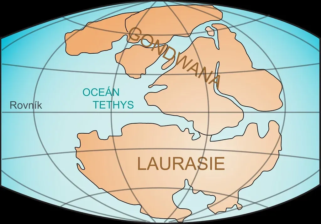
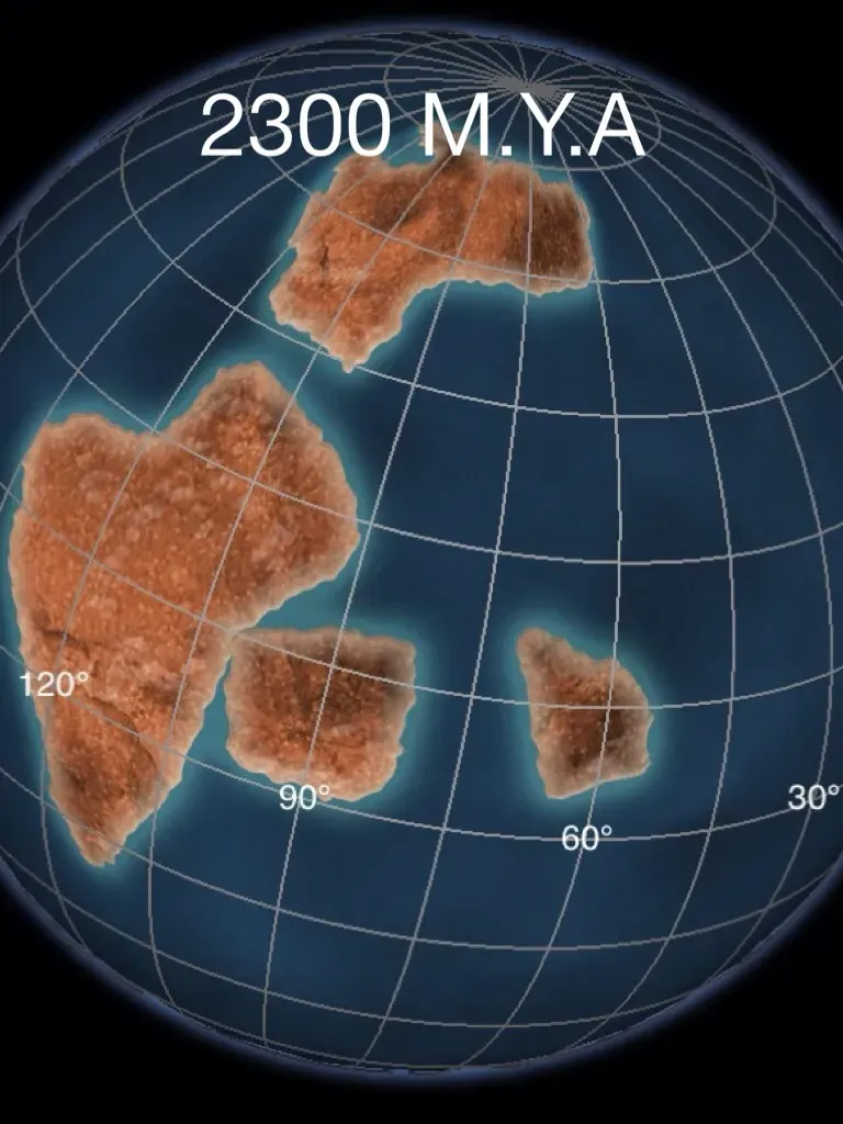
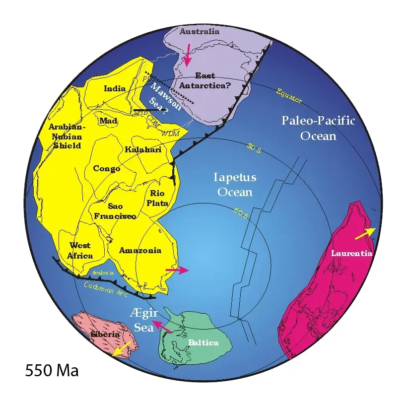
If you could rewind the planet’s history, you would not see Gondwana appear in a single dramatic moment. Instead, you would watch earlier landmasses crash together in slow, grinding collisions that took tens of millions of years. Around the late Precambrian to early Paleozoic eras, ancient continental fragments and microcontinents merged in a series of mountain-building events, slowly welding together what would become Gondwana.
You can imagine this as continents acting like enormous tectonic bumper cars, except the impacts do not bounce them apart; they stitch them together. As these collisions happened, enormous mountain ranges rose where the edges met, forming belts that geologists can still trace today across separate continents. When you hear that rocks in Brazil line up almost perfectly with rocks in West Africa, you are actually glimpsing the scars of those early unions that built Gondwana into a single super-sized landmass.
A World Turned South: Life on a Polar Supercontinent
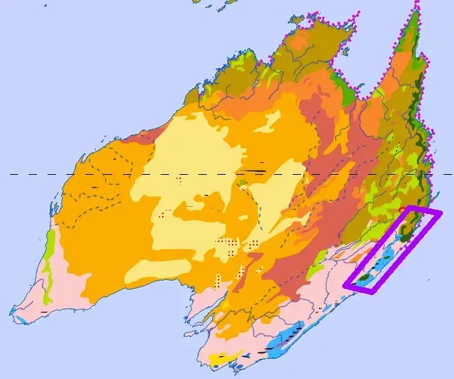
Once Gondwana came together, much of it drifted close to the South Pole, creating a world that would feel completely alien to you. Imagine a continent larger than today’s combined Africa and South America sitting under polar skies, with massive ice sheets spreading across what are now warm regions. You would find glaciers carving into rocks that, millions of years later, would lie in India, South Africa, and Australia.
Yet this polar world was not just an icy wasteland. Over long stretches of time, climate shifted, seas flooded low-lying areas, and lush forests spread when conditions warmed. If you were standing on Gondwana during one of those warmer intervals, you might walk from swampy coal-forming forests in what is now Australia to river plains in what is now South America, never crossing an ocean. The idea that you can find similar fossil plants and glacial deposits in such widely separated modern continents is one of the strongest clues that you are dealing with a once-united polar supercontinent.
You do not need a time machine to see evidence of Gondwana; you just have to know where to look. When you read that the same extinct reptile Lystrosaurus turns up in rocks in Antarctica, India, and South Africa, you are hearing the fossil record quietly insisting that these pieces were once joined. Tiny details in ancient bones and leaf impressions are like passport stamps proving that animals and plants once roamed freely across a connected land.
As you follow this fossil trail, you start to realize how bizarre it would be for identical species to cross entire oceans, especially before birds could fly long distances or humans built ships. Instead, it makes more sense that there were no oceans between these regions at all. By matching fossil species, rock types, and old climate indicators like coal seams and glacial scratches, you are effectively reassembling an ancient map of Gondwana in your head, one clue at a time.
The Slow Breakup: When Gondwana Started to Drift Apart
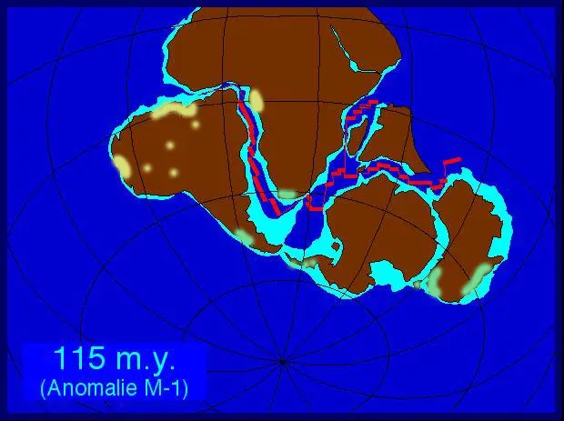
At some point, even the most closely knit group starts to drift, and Gondwana was no exception. During the Mesozoic era, as dinosaurs roamed, heat and movement deep within Earth’s mantle began to stretch and thin the crust beneath Gondwana. If you could stand there then, you would not see continents racing away, but you might one day notice volcanic activity increasing and rift valleys forming as the supercontinent started to crack.
First, great rift systems opened and slowly widened into young oceans, peeling South America away from Africa and separating India, Antarctica, and Australia. You can think of it like slowly tearing apart an ancient atlas: the paper does not rip all at once, but along lines of weakness. As new ocean crust formed between the fragments, the once-continuous coastlines pulled apart, leaving behind matching edges and geological fingerprints that you can still pair together on opposite sides of today’s oceans.
Gondwana’s Children: How Its Fragments Shaped Today’s Continents
When you look at your modern globe, you are really looking at the scattered pieces of Gondwana that have gone on to live very different lives. India, for example, did not just drift gently; it raced northward on a geologic timescale and slammed into Asia, helping to create the Himalayas. Australia moved into lower latitudes and warmed, giving it the chance to develop unique ecosystems packed with marsupials and other distinctive species.
Meanwhile, Antarctica took a colder, lonelier path, drifting over the South Pole and becoming isolated by a powerful circumpolar current that helped trap cold air and ice. Africa remained closer to its original Gondwanan core, while South America slid westward and later met the Pacific tectonic plates, raising the Andes. When you trace these journeys, you start to see each continent not as a fixed identity, but as a traveler with roots in the same ancient homeland.
Why Gondwana Still Matters to You Today
You might wonder why you should care about a supercontinent that disappeared long before humans existed. The answer is that Gondwana still shapes the world you live in, from the resources you use to the landscapes you see. Coal deposits, metal-rich mountain belts, and oil basins in former Gondwanan regions often formed because of the way that ancient land fused, warped, and later broke apart.
Even modern climate and biodiversity patterns still carry Gondwana’s fingerprints. When you see similar plant families in far-flung parts of the Southern Hemisphere, or when you notice that certain animals in South America and Australia seem strangely related, you are really seeing echoes of that shared past. By understanding Gondwana, you are not just learning about something that is gone; you are decoding why your present-day continents look, behave, and connect the way they do.
In the end, tracing the prehistoric journey of Gondwana is like discovering a hidden family tree for the continents you thought you knew. You now know that Africa, South America, Antarctica, Australia, India, and Arabia are not random shapes floating alone, but siblings that once shared a single, vast home before drifting into their current positions. When you look at a world map again, maybe you will see less of a static picture and more of a frozen frame in a very long film. If you could watch the next few hundred million years, what new supercontinent do you think you would see forming from these familiar pieces?