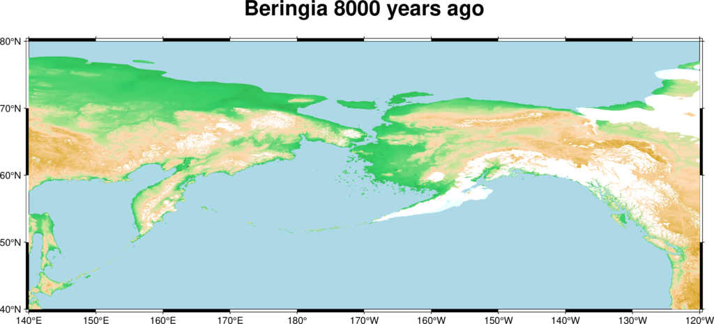
Imagine a vast, wind-swept plain stretching over a thousand miles from north to south, connecting two continents, teeming with enormous creatures that thundered across the frozen ground. No ocean. No strait. Just land, grass, and life on an almost incomprehensible scale. That was Beringia, and for tens of thousands of years, it was one of the most consequential corridors in the history of life on Earth.
You might think of the Americas as always having had their own distinct wildlife, isolated and untouched. The truth is far more dramatic. The animals that came to define two whole continents, including some you’d never guess were ever visitors, all owe their existence in the New World to a single geological accident. So let’s dive in.
What Was the Bering Land Bridge, and Where Did It Come From?
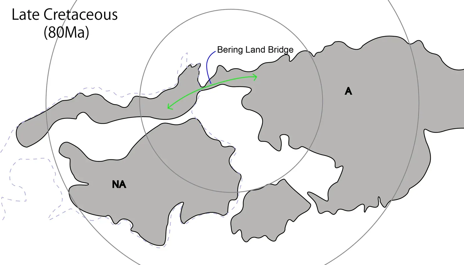
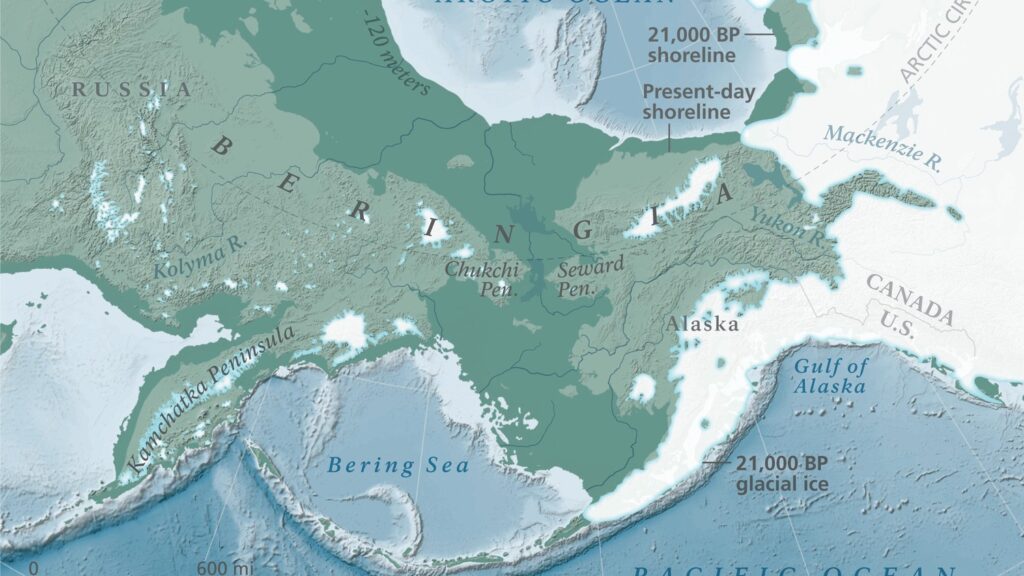
Here’s the thing: the Bering Land Bridge wasn’t some narrow strip of rock barely wide enough to cross. At its greatest extent, it was up to 1,000 km wide and covered an area roughly as large as British Columbia and Alberta combined, totaling about 1.6 million square kilometers, allowing biological dispersal to occur between Asia and North America. Think of it less like a bridge and more like an entire country that no longer exists.
The Bering Land Bridge emerged as a result of dramatic climatic and geological changes during the Ice Age, particularly in the Pleistocene Epoch. During this time, glaciers trapped vast amounts of the Earth’s water, causing sea levels to drop by as much as 400 feet, which exposed the land bridge. In other words, the ocean floor became dry land simply because so much of the planet’s water was locked up in ice. It’s honestly one of the most staggering natural engineering feats imaginable.
The sea level rose and fell throughout glacial times, and the connection between Alaska and Siberia was established and broken repeatedly. Various land organisms crossed the bridge when it was available, but exchange between the continents was blocked when it was inundated. This cycle of opening and closing turned Beringia into a kind of prehistoric revolving door for life itself.
What Did the Landscape Actually Look Like?
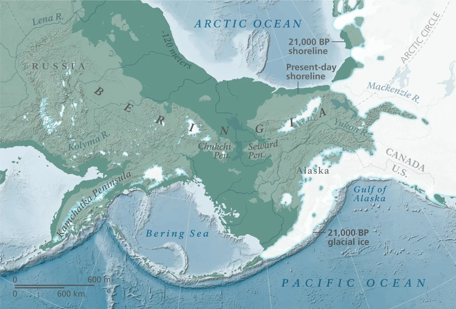
The land bridge was not a narrow isthmus, but rather a huge tundra landscape bounded by the stocky shoulders of two continents and stretching more than one thousand miles from north to south. Scientists believe Beringia was at its widest point about 21,000 years ago. Try picturing that the next time you look at a modern map of the Bering Strait, where today only about 60 miles of water separates Asia from Alaska.
Unlike much of North America at the time, Beringia remained ice-free because the climate was too dry for ice sheets or glaciers to form. Pollen studies show this climate turned the land bridge into a vast plain of grasses, herbs, and flowers perfect for grazing herds. Fossils found in the area indicate woolly mammoths, steppe bison, and Yukon horses lived on and migrated across the land bridge. Honestly, it sounds more like a prehistoric Serengeti than a frozen wasteland, which is exactly what makes it so fascinating.
While traditionally believed to be a vast, flat, treeless plain, evidence from sediment cores in the Bering Sea suggests there may have been “refugia” of dwarf shrubs and even trees in some places. Science keeps revising the picture, and the land bridge gets more interesting with every new discovery.
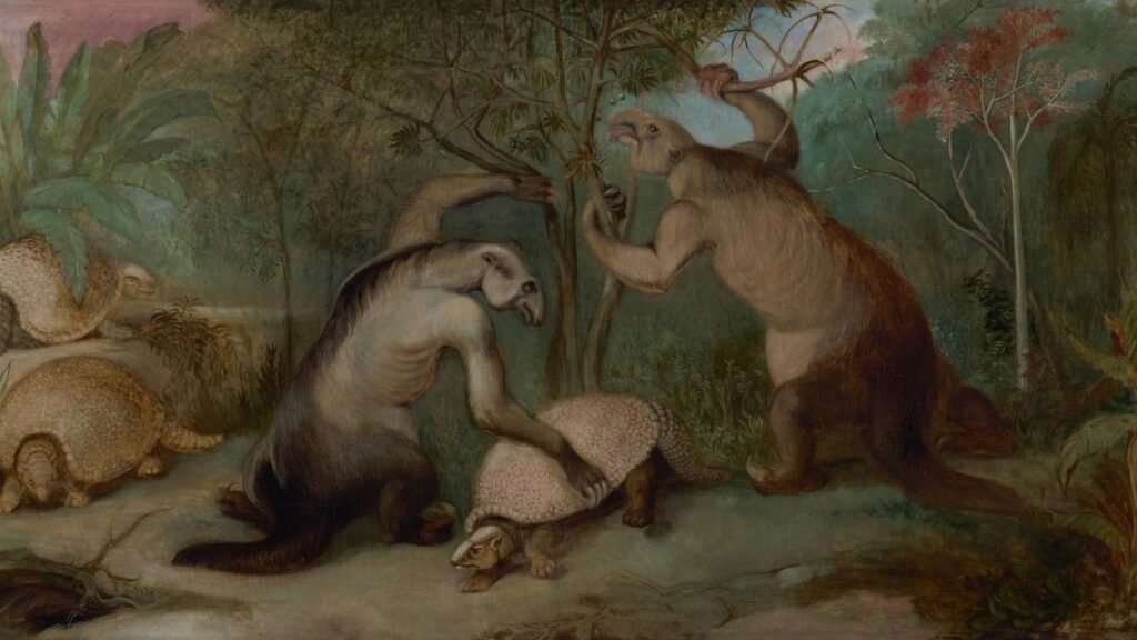
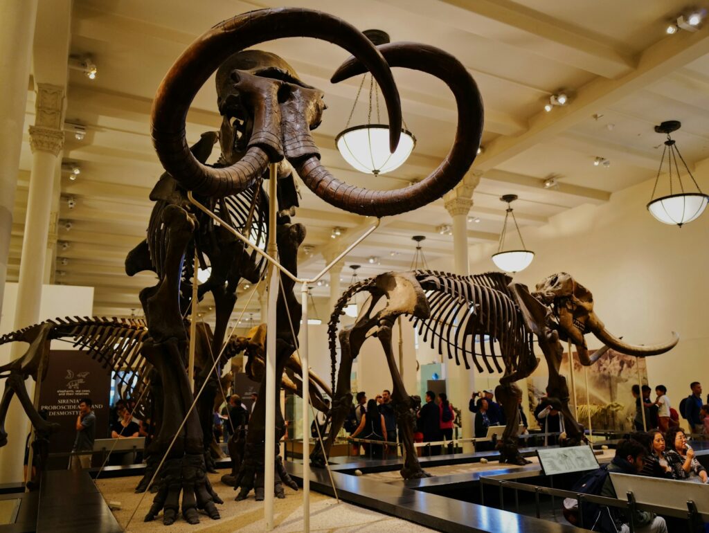
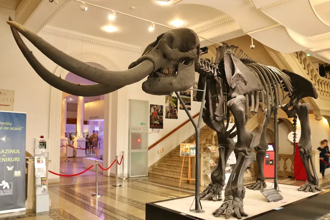
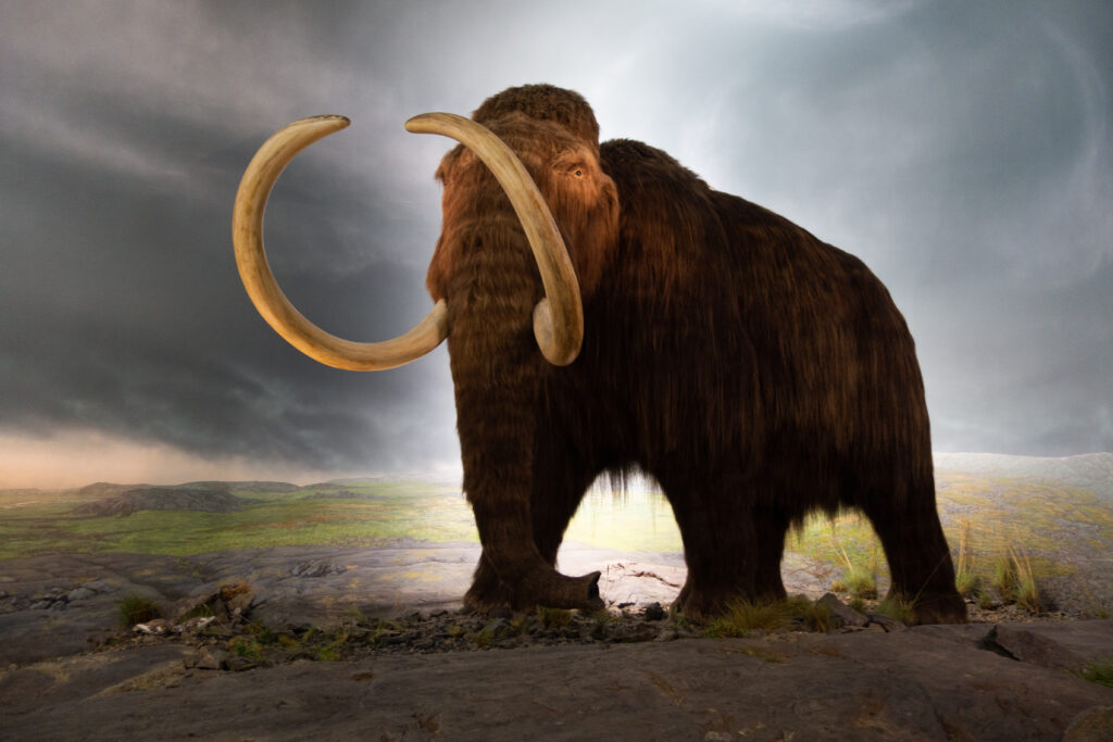
The Giants That Made the Journey: Woolly Mammoths and Ice Age Megafauna

Beringia’s Ice Age iconic megafauna included the mastodon, woolly mammoth, woolly rhino, lion, and short-faced bear, all of which are now extinct. These weren’t just large animals. They were ecological architects, shaping vegetation, soil, and entire landscapes simply by moving through them. An adult woolly mammoth stood over 3 metres tall and consumed 200 kilograms of grass each day. That’s roughly the weight of a full-grown lion. Every single day.
A corridor was created by falling sea levels that provided an opportunity for Asian species including mammoths, bison, muskoxen, caribou, lions, brown bears, and wolves to move into North America. The migration wasn’t just one species at a time. It was an entire ecosystem on the move. While the distribution of woolly mammoths extended from Europe across Siberia into North America, it is possible that some eastern Beringian males dispersed westward long distances, just as modern male elephants do, but female mammoths mostly stayed on just one side or the other of the land bridge. Even in prehistory, gender differences in ranging behavior apparently mattered.
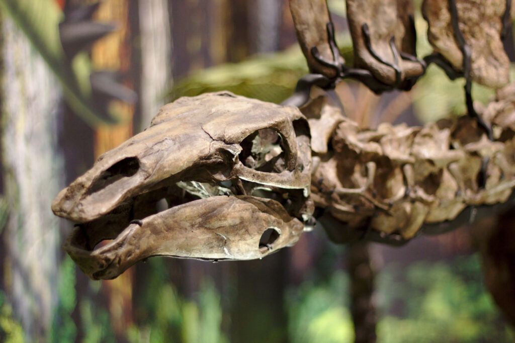
The Surprising Truth About Horses and Camels: America’s Original Exports
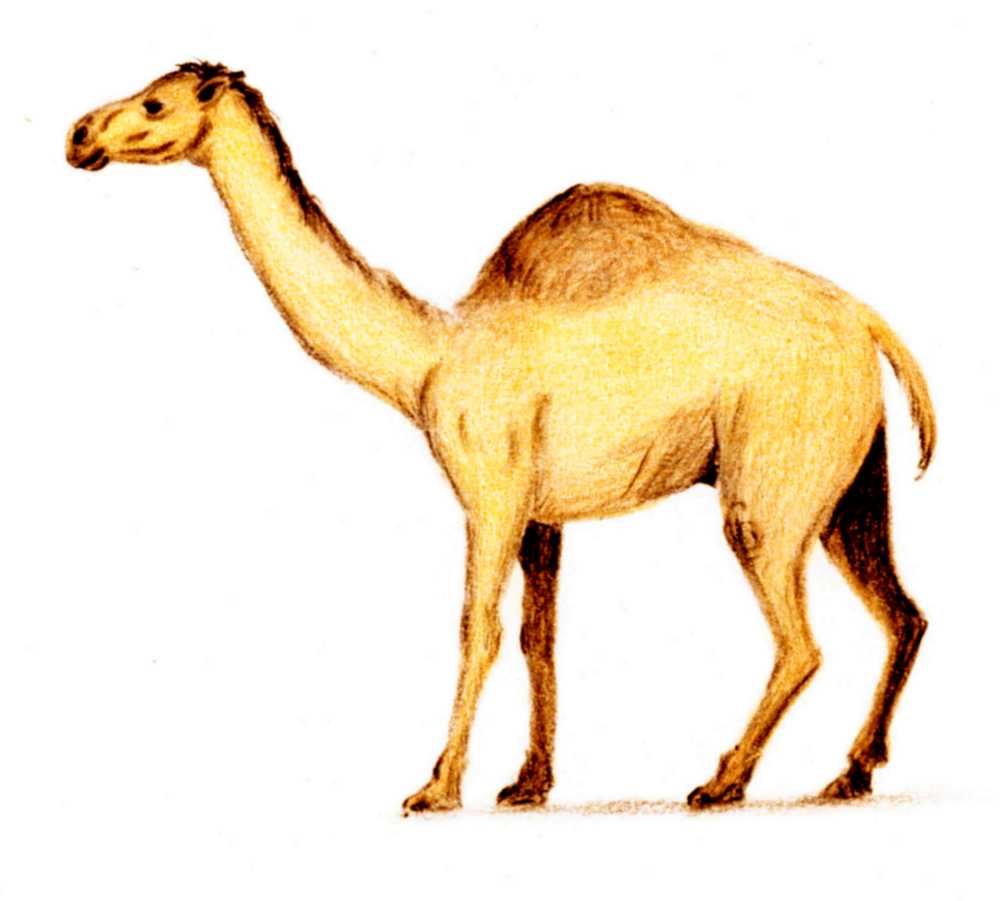
I know it sounds crazy, but the animals most people associate with the deserts of Arabia and the plains of Asia actually started their story in North America. It is a little known fact that camels originated in North America. Many people are surprised to learn that horses first appeared in North America too. Both eventually made their way across Beringia heading west, not east, which flips the entire migration story in a fascinating direction.
Camelids originated in North America during the Eocene, with the ancestor of modern camels, Paracamelus, migrating across the Bering Land Bridge into Asia during the late Miocene, around 6 million years ago. Once in Asia, they diversified and thrived, eventually becoming the camels of Arabia and Central Asia that we recognize today. Horses migrated between continents not only in one direction but vice versa. The first wave of migration was predominantly from North America to Eurasia. The second migration was dominated by the movement from Eurasia to North America. The land bridge, in short, was a two-way street, and the animals were far more cosmopolitan than most people realize.
North American species such as horses and camels migrated into Asia, while Asian species like mammoths and saber-toothed tigers journeyed into North America. This bidirectional movement enriched biodiversity on both continents and played a pivotal role in shaping evolutionary pathways. You could almost think of it as a prehistoric trade agreement, with each continent sending its best creatures to the other.
What Stopped the Migration? The Closing of the Bridge
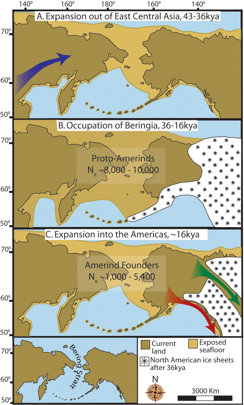
The Ice Age reached its peak during the Last Glacial Maximum, when ice sheets began advancing from 33,000 years ago and reached their maximum limits 26,500 years ago. Deglaciation commenced in the Northern Hemisphere approximately 19,000 years ago, and the bridge was finally inundated around 11,000 years ago. When the ice melted, all that trapped water rushed back into the ocean, and the land simply disappeared beneath rising seas.
The Yukon corridor opened between the receding ice sheets around 13,000 years ago, and this once again allowed gene flow between Eurasia and continental North America until the land bridge was finally closed by rising sea levels around 10,000 years ago. There was a brief, final window of passage before the continents were permanently separated. The disappearance of the Bering Land Bridge around 11,000 years ago led to the isolation of plant and animal populations, driving distinct evolutionary pathways. The earlier exchange of species had enriched the genetic pool and fostered ecological resilience on both continents. In a sense, the closing of the bridge was just as important as its opening.
The Mass Extinction: What Happened to All Those Animals?
Here’s where things get genuinely puzzling, and honestly, a little heartbreaking. The end of the Pleistocene was marked by the extinction of many genera of large mammals, including mammoths, mastodons, ground sloths, and giant beavers. The extinction event is most distinct in North America, where 32 genera of large mammals vanished during an interval of about 2,000 years, centered on 11,000 years ago. That’s a staggering collapse of biodiversity in what amounts to the blink of an eye in geological time.
The timing and severity of the extinctions varied by region and are generally thought to have been driven by humans, climatic change, or a combination of both. Human impact on megafauna populations is thought to have been driven by hunting, as well as possibly environmental alteration. The debate between those two causes, climate change versus human hunting, has been raging among scientists for decades and remains unresolved. The results of research suggest that the causes for extinctions varied across taxa and by region. In some cases extinctions appear linked to hunting, while in others they are consistent with the ecological effects of climate change, and in at least one case, both hunting and climate change appear responsible. It’s hard to say for sure, but most researchers today lean toward the idea that both factors worked together like a one-two punch.
A more likely explanation for the extinctions is that the prolonged warming at the end of the Pleistocene caused environmental changes that did not favor the Mammoth Steppe megafauna. The grasses these giants depended on were replaced by shrubs and bogs. Of the 13 megafauna taxa present in eastern Beringia immediately before 15,000 years ago, only seven survived beyond the Pleistocene, including steppe bison, caribou, wapiti, muskox, wolf, grizzly bear, and sheep. The remaining taxa, including caballine horses, woolly mammoth, saiga antelope, lion, and short-faced bear, became regionally extinct throughout large areas. The survivors, it turns out, were the more adaptable ones.
What the Bering Land Bridge Means for Us Today
Fossil evidence strongly supports the belief that, over time, the various land bridges allowed plants and animals to move between the Old and New Worlds. The legacy of these migrations is written into the DNA of living species, the structure of modern ecosystems, and even into the ancestry of people alive today. Genetic studies reveal that individuals across Canada, North America and South America share direct ancestral links with populations in present-day Eastern Russia, highlighting the impact of this ancient land bridge. The bridge is gone, but its fingerprints are everywhere.
The pattern of bidirectional flow of biota has been asymmetric, with more plants, animals, and fungi generally migrating from Asia to North America than vice versa throughout the Cenozoic. Yet the reverse migrations of horses and camels remind us that the story was never entirely one-directional. The impact of the Bering Land Bridge serves as a reminder of the pivotal role geographical features play in shaping biodiversity. Even today, the shared ancestry of certain plants and animals in Asia and North America stands as evidence of these ancient migrations. Every bison grazing on the American plains, every caribou crossing the tundra, carries within it a story that began on the other side of the world.
Conclusion
The Bering Land Bridge was not just a geological curiosity. It was the stage for one of the most extraordinary wildlife dramas in Earth’s history. Continents exchanged their finest creatures across a land that no longer exists, and the consequences of those crossings still shape the natural world we live in today. Horses born in North America conquered the deserts of Asia. Mammoths born in Eurasia ruled the American plains. Whole ecosystems rose and fell on the back of a corridor of frozen tundra and grass.
What makes the story even more compelling is how much we are still discovering. Recent research continues to push back and revise our understanding of when the bridge opened, which species crossed, and why so many of them ultimately vanished. The science is alive, dynamic, and full of surprises. So the next time you see a camel in a documentary or a wild horse running across a screen, you might just find yourself wondering: did you expect that the Americas were once their home?