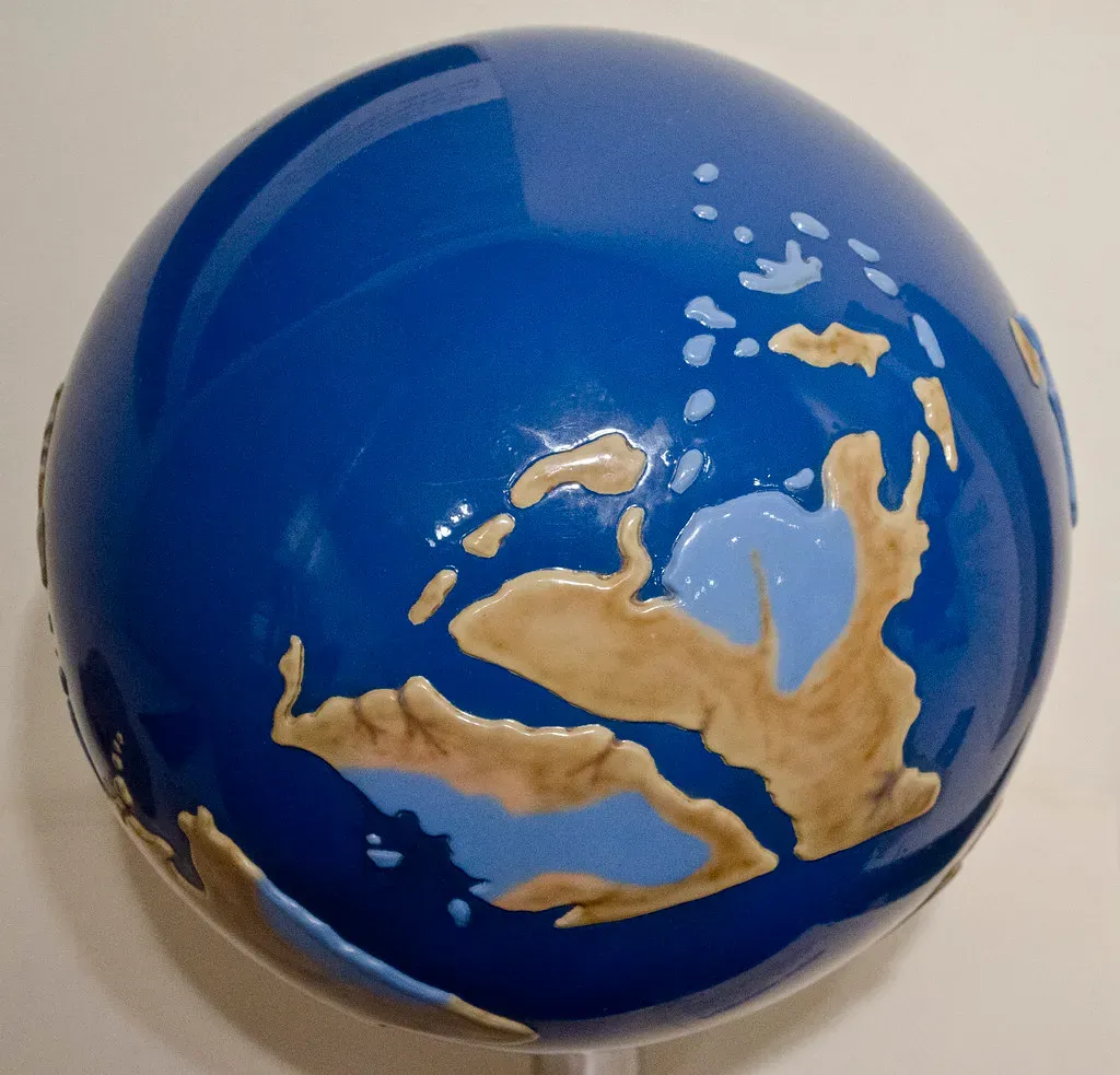
Imagine opening a world map and seeing no Atlantic Ocean at all. Instead of scattered continents, there’s one enormous landmass stretching almost from pole to pole, ringed by a single vast ocean. That’s not science fiction or a fantasy novel backdrop; that’s our own planet about 200 million years ago, when Earth’s land was fused into one supercontinent called Pangaea. Just thinking about dinosaurs roaming from what’s now New York all the way to North Africa without ever touching a shoreline is wild enough to make you rethink everything you thought you knew about geography.
Pangaea is one of those ideas that seems almost too dramatic to be real, yet it’s one of the most solidly backed stories in Earth’s history. It rewrites our sense of distance, climate, evolution, and even why continents look like puzzle pieces today. Once you start digging into how Pangaea formed, how it broke apart, and what traces it left behind, our familiar blue marble suddenly feels more alive, more mysterious, and more changeable than we usually give it credit for.
The Big Mash-Up: How Pangaea Came Together
Pangaea did not pop into existence overnight; it was the result of a very slow, very violent planetary dance that played out over hundreds of millions of years. Long before Pangaea, there were older supercontinents like Rodinia and Gondwana that formed and broke up in earlier cycles. As Earth’s internal heat drove the motion of tectonic plates, smaller continents and island arcs collided, crumpled, and welded together like cars in a slow-motion pileup. Every collision built mountain ranges, thickened crust, and stitched once-distant bits of land into a growing mega-continent.
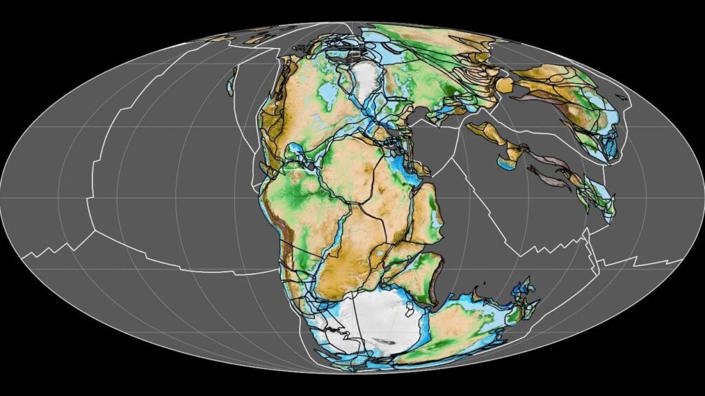
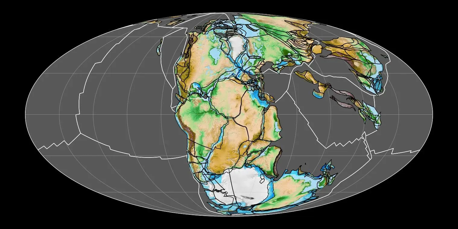
By roughly about 335 million years ago, most of the world’s major landmasses had merged into a single body: Pangaea, surrounded by a global ocean often called Panthalassa. Picture what is now North and South America pressed up against Africa and Europe, while huge regions of Asia were tucked into the mix to the north and east. The forces involved were immense – plates grinding together, subduction zones swallowing ocean crust, volcanic arcs flaming along the edges. In human terms, it’s like watching continents travel the distance from New York to Los Angeles, but stretched over tens of millions of years so slowly you’d never see them move in a lifetime.
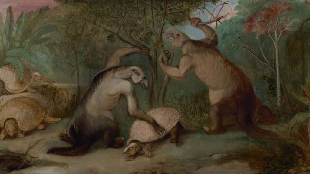
Life On A Supercontinent: Dinosaurs, Deserts, And Drastic Weather
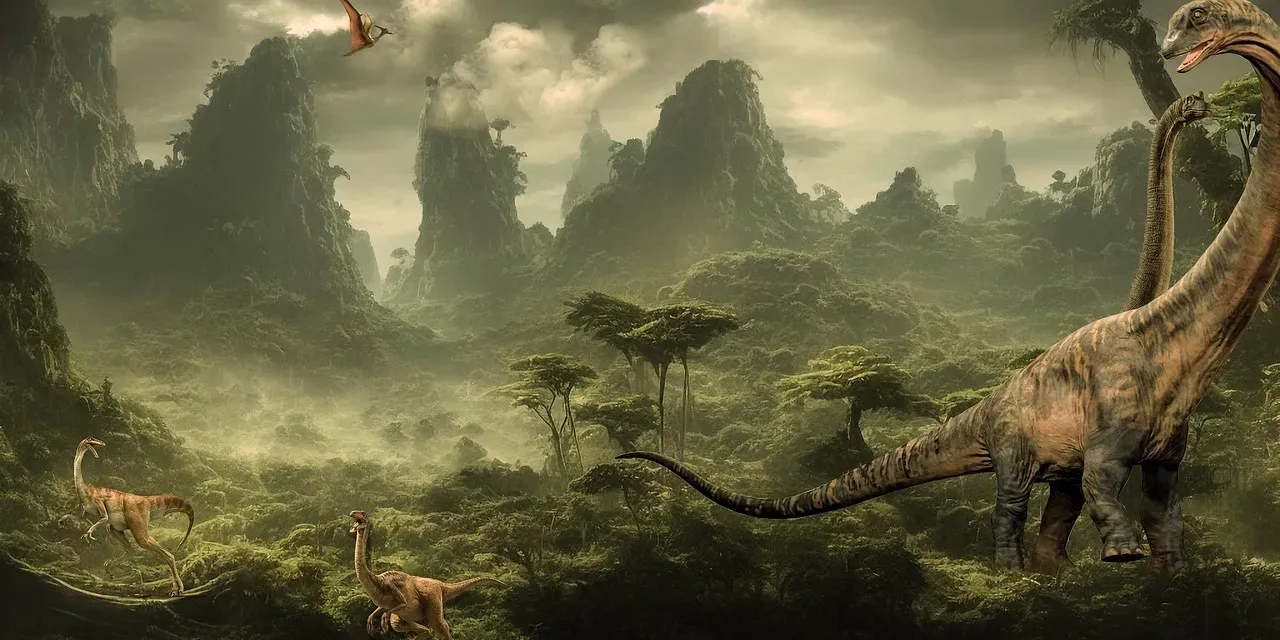
So what was it actually like to live on Pangaea – if you happened to be a reptile, amphibian, or early mammal ancestor? The climate of a supercontinent is extreme because of its sheer size. With so much land in one continuous mass, the interior regions were incredibly far from the moderating influence of the ocean. That meant intense seasonal swings, blistering hot summers, and cold, dry winters in many interior zones. Vast deserts spread across central Pangaea, larger than today’s Sahara, while coastal regions enjoyed more humid, temperate climates.
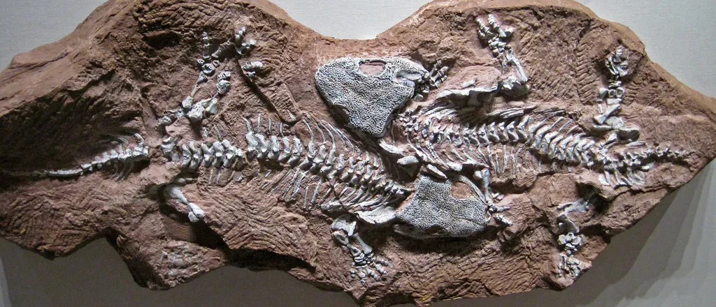
At the same time, Pangaea was a highway for life. With no ocean barriers between what we now call continents, plants and animals could spread over enormous distances. Similar fossil species show up today in rocks in South America, Africa, India, and even Antarctica, telling us they once shared a connected landscape. Early reptiles and the first dinosaurs could roam across huge stretches of land, and that open access likely helped certain groups dominate. Ironically, the very layout that helped life spread also made it vulnerable; when climates shifted or extinction events struck, they could ripple across Pangaea’s connected ecosystems like a shockwave.
The Clues In The Rocks: How We Know Pangaea Was Real
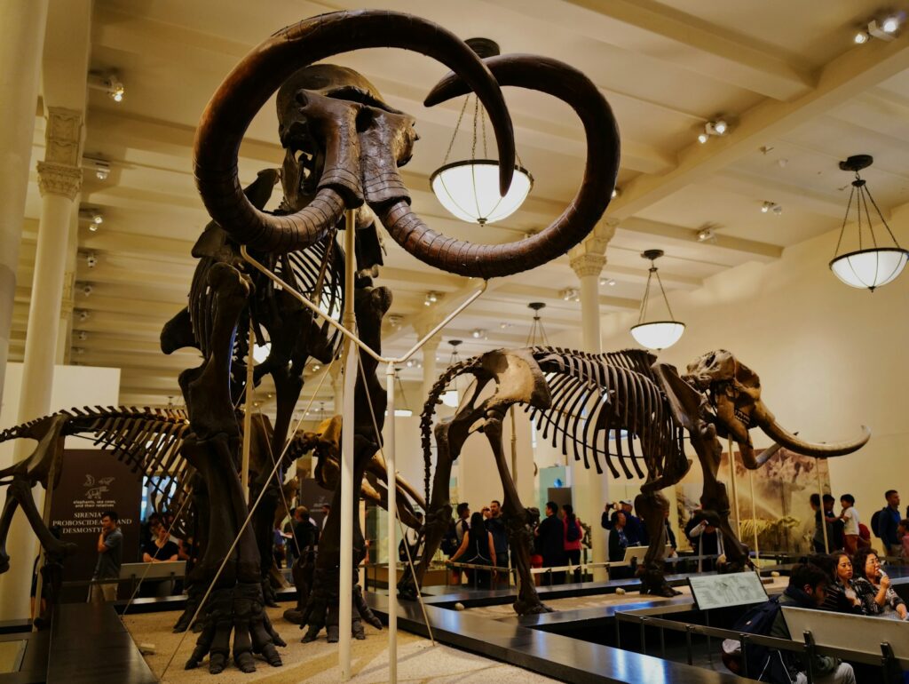
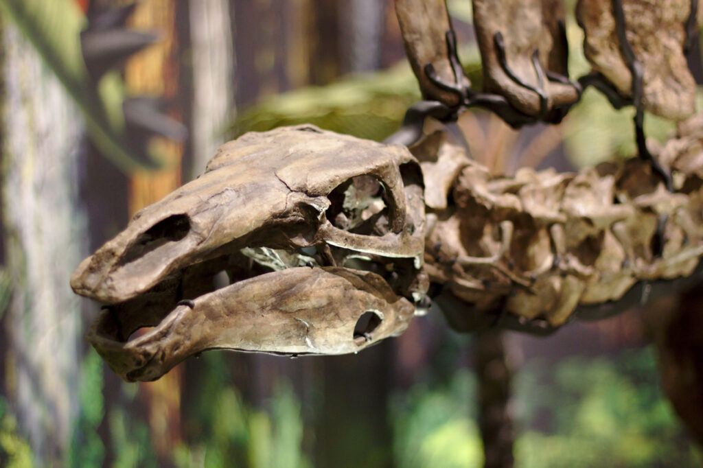
The idea that continents move used to sound outrageous. For a long time, the shapes of coastlines – South America fitting into Africa like two puzzle pieces – were dismissed as coincidence. The turning point came when geologists started to spot patterns that only made sense if those continents had once been joined. Identical rock layers, matching mountain belts, and the same ancient fossils were found on shores now separated by thousands of kilometers of ocean. It was like finding pages of the same book torn out and scattered around the world.
Even more convincing evidence came from paleoclimate markers and magnetic minerals. Glacial scratches and deposits that formed near the poles now sit in tropical regions, but when you reassemble the continents into Pangaea, those glacial features snap right back into polar positions. Magnetic minerals in ancient rocks also record the direction of Earth’s magnetic field at the time they formed, capturing the latitude where they solidified. When those directions are plotted, they line up beautifully if the continents are moved back into Pangaea’s configuration. At this point, the question is not whether Pangaea existed, but how precisely the puzzle pieces fit together.
Breaking Apart: From One Supercontinent To Today’s World Map
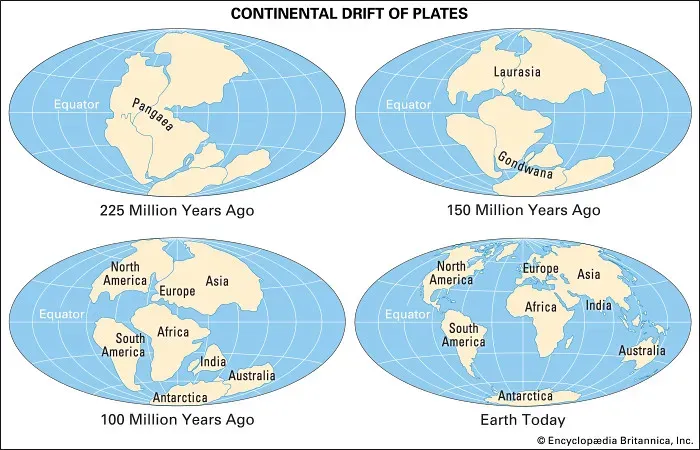
As stable as Pangaea might look in artists’ reconstructions, it was always living on borrowed time. Earth’s mantle kept flowing, heat kept building beneath thickened crust, and eventually, that stress began to tear the supercontinent apart from the inside. Around 200 million years ago, rifting began to split Pangaea into two huge chunks: Laurasia in the north and Gondwana in the south. Those rifts widened into new ocean basins, the early ancestors of what we now call the Atlantic and Indian Oceans.
Over tens of millions of years, those chunks fractured further into the continents we recognize today. Africa drifted away from South America, India raced northward to slam into Asia and raise the Himalayas, and Australia peeled off to go its own way into the Southern Hemisphere. The map you grew up with is just a screenshot of this breakup process midstream. If you zoomed out in time, you’d see continents gliding around like slow-motion rafts on a molten sea, sometimes colliding to make mountains, other times drifting apart to form oceans – and Pangaea was simply the last great moment when almost all of them happened to be fused together.
Why Pangaea Still Shapes Our Mountains, Fossils, And Resources
Even though Pangaea split long ago, it left fingerprints all over the modern world. Some of the great mountain ranges we see today – like the Appalachians in North America and related ranges in Europe and North Africa – are the eroded remnants of collisions that helped build Pangaea in the first place. When geologists compare the rocks and structures on both sides of the Atlantic, they see that these ranges were once part of the same continuous mountain belt crushed together in that ancient super-merge. What looks like separate chains now are really scattered shreds of a much bigger original.
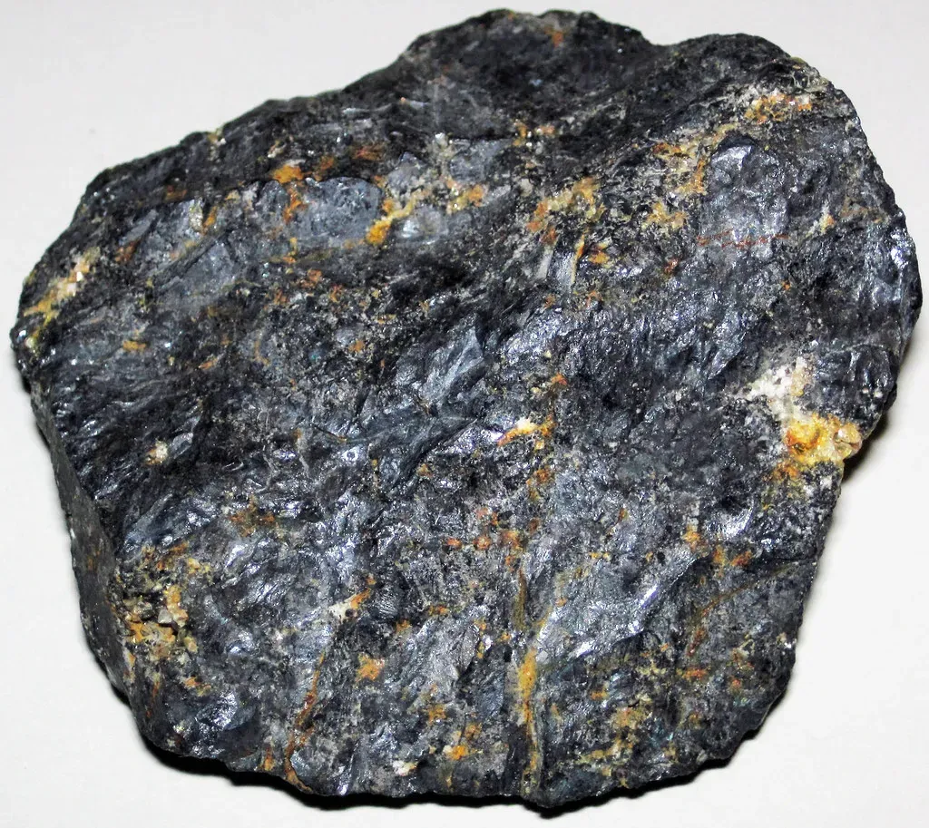
Pangaea also influenced where many of our natural resources ended up. Thick layers of plants that grew in its vast coastal swamps and deltas were buried and transformed over time into coal, oil, and gas, which are now found in patterns that only truly make sense on a Pangaea-style map. The distribution of certain mineral belts, like copper or iron formations, also ties back to tectonic settings along the edges and interiors of that supercontinent. When companies search for resources today, they may not talk about Pangaea in their commercials, but the science that guides their exploration is deeply rooted in how that ancient world was put together and ripped apart.
Pangaea And Plate Tectonics: The Planet’s Long Game
Pangaea is not just a cool fossil of a world map; it is one chapter in a recurring pattern called the supercontinent cycle. Plate tectonics drives continents to wander the globe, collide, merge, and then fragment over spans of hundreds of millions of years. Before Pangaea, there were older supercontinents, and after Pangaea, the plates have kept on moving, setting up the configuration we live on today. When you understand that cycle, the idea that continents once sat together stops being strange and starts feeling inevitable.
This long game changes how we think about stability. We tend to see our current geography as fixed and permanent, but Pangaea is a reminder that coastlines are temporary and oceans are experiments. The Atlantic Ocean, which seems so vast and timeless, is actually a relatively young feature that opened as Pangaea cracked apart. In the deeper future, new collisions and breakups will reshape everything again. From this perspective, our borders and place names are like chalk drawings on a sidewalk before the next rain; plate tectonics will eventually erase and redraw them.
Will There Be Another Pangaea? Peeking Into Earth’s Future
If Earth has already cycled through several supercontinents, it is reasonable to expect another one in the distant future. Geologists have proposed various possible future supercontinent scenarios with nicknames like Pangaea Proxima, Amasia, or Novopangaea, each describing different ways the current continents might reconverge. Some models imagine the Atlantic eventually closing as the Americas drift back toward Africa and Europe; others lean on the Pacific shrinking, bringing Asia and the Americas together into a northern supercontinent. None of these ideas is certain, but taken together they send a clear message: the continents are still on the move, and the story is far from over.
The timescales involved are almost beyond human imagination – hundreds of millions of years into the future – so this is not something our species will likely witness. Still, thinking forward to a new Pangaea-type world forces us to confront our own smallness in geological time. Climate, ocean circulation, biodiversity, and even the appearance of the sky from a given point on land would all be radically different on a new supercontinent. When you realize that our age fits into just a thin slice between Pangaea’s past and some future supercontinent, it becomes harder to see the present as the default setting for Earth.
Why Pangaea Matters Now: A Personal Take
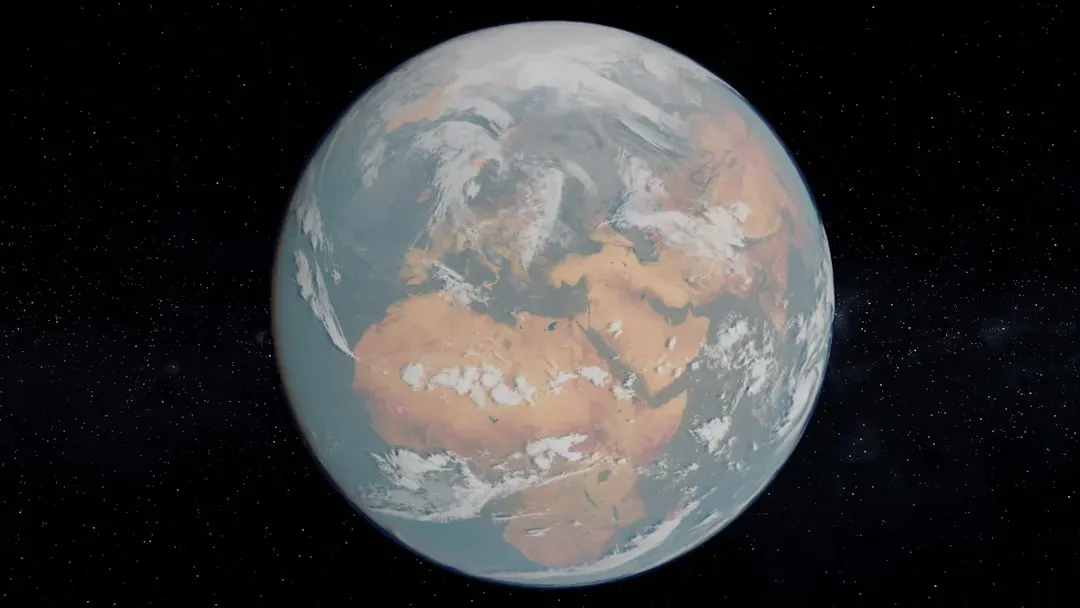
![Why Pangaea Matters Now: A Personal Take (I did myself based on [1], also I added it on my dinosaur website (the link is [2]), CC BY-SA 2.5)](https://nvmwebsites-budwg5g9avh3epea.z03.azurefd.net/dinoworld/b6d3179306e2ce1827034db401e5bf89.webp)
It’s tempting to treat Pangaea as a fun trivia fact, the kind of thing you vaguely remember from a classroom poster and then forget as you go back to everyday life. But for me, the more I think about Pangaea, the more it feels like a quiet challenge to our usual sense of certainty. We plan cities, build nations, and talk about permanent borders on a planet whose surface is essentially drifting puzzle pieces. Pangaea is proof that what feels unshakable today can be wildly different tomorrow on geological timescales, and that humility is oddly comforting. It suggests that change is not an exception; it is the rule.
If I’m honest, I find something almost rebellious about letting Pangaea reshape how I look at a world map. Instead of seeing continents as isolated, competing blocks, I see them as fragments of a once-unified land that will probably merge and scatter again long after we’re gone. That does not mean our choices today are meaningless; in fact, knowing how temporary our arrangement is makes our brief moment of influence feel even more precious. The real lesson of Pangaea, at least in my view, is that Earth’s story is bigger and stranger than our current chapter, and we get to decide whether we act like short-term renters or thoughtful guests. If you picture the continents inexorably sliding toward their next grand meeting, what kind of mark do you actually want our tiny era to leave behind?