You grow up with this quiet assumption that deserts are empty. Just dunes, mirages, and maybe the odd camel postcard. Then archaeology taps you on the shoulder and whispers that under those rolling sands lie streets, walls, temples, and entire river systems that once shaped human history. Suddenly the Sahara, the Arabian Peninsula, and the coastal deserts of Peru stop being blank spaces and become palimpsests, layered with forgotten lives you were never told about in school.
In the last few decades, the pace of discovery has exploded. Archaeologists are now using orbiting satellites, radar that can see beneath sand, and even artificial intelligence to reveal cities and landscapes that have been buried for thousands of years. You are living at the exact moment when deserts are ceasing to be “empty” on the map. Once you see how much has been hiding in plain sight, it becomes hard to look at a sand dune – or at the story of civilization – the same way again.
The Myth Of Empty Deserts: What Really Lies Beneath The Dunes
If you picture deserts as lifeless wastelands, you’re carrying around one of the most persistent misconceptions in history. Under your mental image of endless sand, there were once lakes, rivers, caravan hubs, and farming communities that managed to carve out a living in brutal conditions. In parts of Arabia, radar and geological studies have revealed the traces of ancient river valleys and lake basins running below today’s dunes, proving that what you see now is just the latest chapter in a much longer environmental story.
When you hear legends like the “Atlantis of the Sands” or fabled caravan cities swallowed by the desert, they can sound like fantasy – until remote sensing turns up stone foundations and buried roads right where the stories pointed. In the Rub’ al Khali and around the borders of Oman, Saudi Arabia, and the United Arab Emirates, surveys have identified ancient settlements and trackways a few meters under the sand, preserved like pressed flowers in a book you forgot you owned. You start to realize that many myths were not pure invention; they were distorted memories of real landscapes and real people, slowly erased by wind and time.
Space Archaeology: How Satellites And Radar Peel Back The Sands
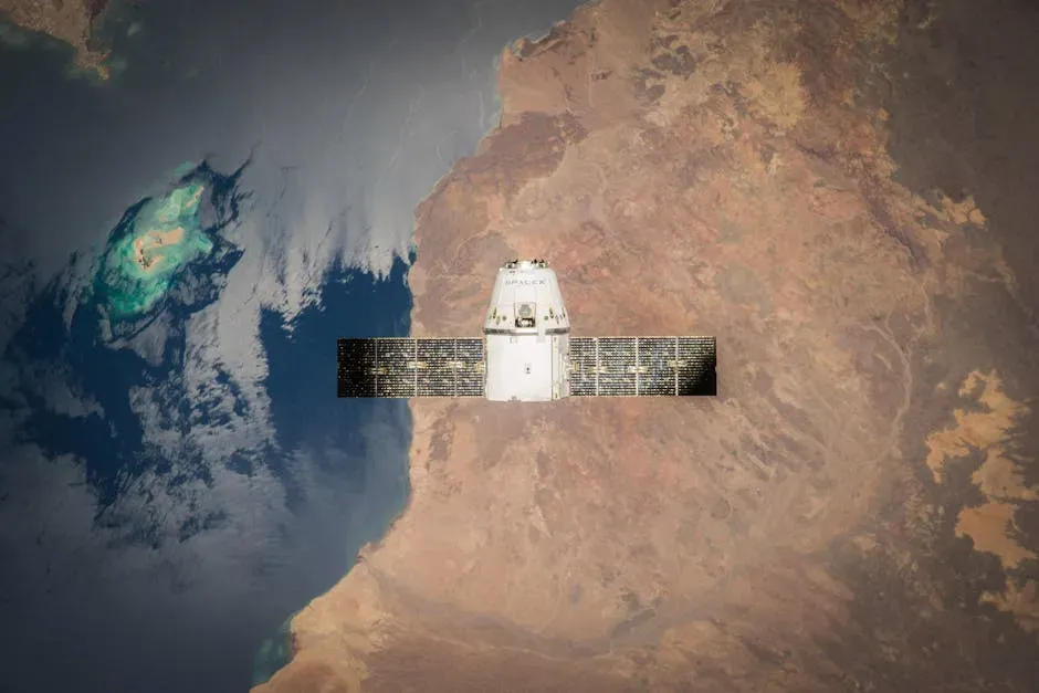
Here’s the wild part: you can now stand on your doorstep, stare up at the night sky, and know that tools orbiting above you are actively rewriting what we know about ancient civilizations. Spaceborne radar and high-resolution satellite imagery can detect patterns that your eyes at ground level could never pick out – straight lines that betray buried walls, faint discolorations that trace long-dead canals, and caravan routes that run like ghost highways beneath modern dunes. In some cases, radar waves even bounce off stone structures hidden under dry sand, allowing researchers to map what lies below without digging a single trench.
Archaeologists then feed all of this data into software that hunts for repeating shapes – the rectangular footprint of a house compound, the grid of a planned city, the sinuous ribbon of an old riverbed. You see the same technology that guides climate monitoring and military surveillance quietly moonlighting as a time machine. Combined with AI, these systems can scan entire deserts that would take you lifetimes to survey on foot, flagging clusters of potential sites. You end up with maps full of “new” cities and settlements, discovered not by chance encounters with sandstorms but by pixels and algorithms.
Lost Cities Of The Arabian Sands: From Caravan Hubs To Hidden Civilizations
When you imagine the Arabian desert in antiquity, it is tempting to think of isolated oases and a few scattered tribes. Modern discoveries are forcing you to trade that image for something far more dynamic. Radar surveys, satellite imagery, and targeted excavations in places like Oman, Saudi Arabia, and the United Arab Emirates have uncovered the remains of fortified settlements, road networks, and ancient water systems buried beneath dunes. These sites point to complex societies that controlled trade routes for incense, copper, and other goods long before Rome or Mecca rose to prominence.
In the vast Rub’ al Khali, often portrayed as the ultimate empty quarter, researchers have detected the footprints of urban centers that operated in climates not so different from your own today – proof that people adapted and thrived where modern common sense says they should not. Projects around Dubai and across the peninsula are now using synthetic aperture radar combined with machine learning to pick out stone structures and road traces under the sand, revealing a connected landscape instead of isolated dots. As you follow these findings, the desert stops looking like civilization’s edge and starts to feel like one of its original engines.
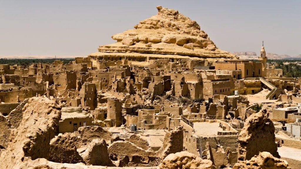
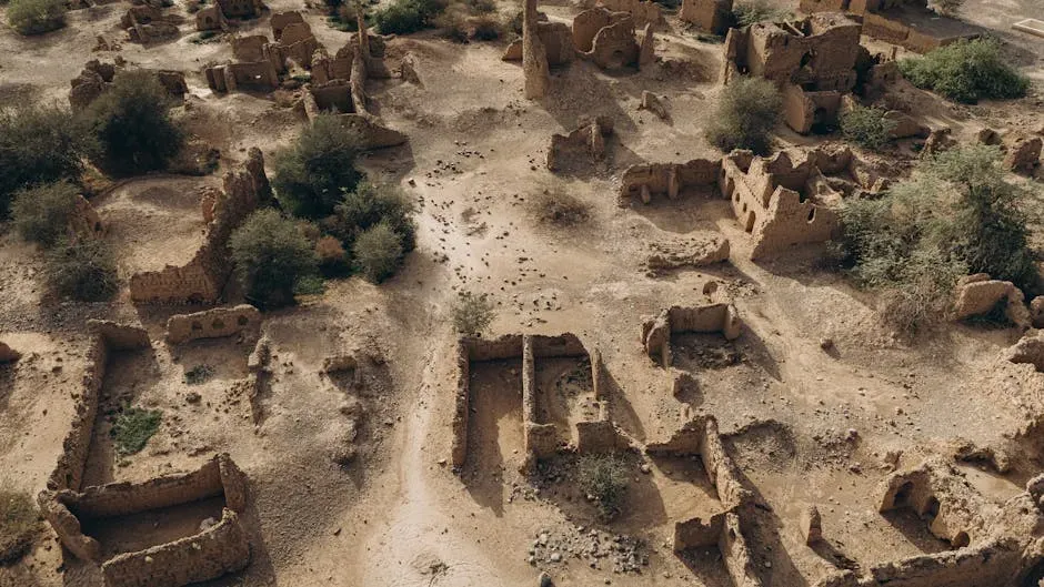
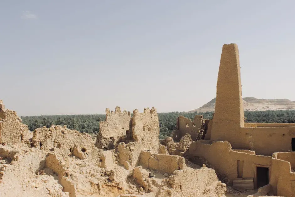
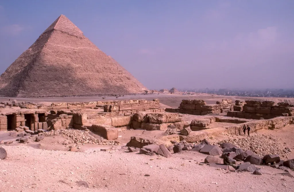
Egypt’s Buried Neighborhoods: Cities And Sacred Spaces Under The Sand
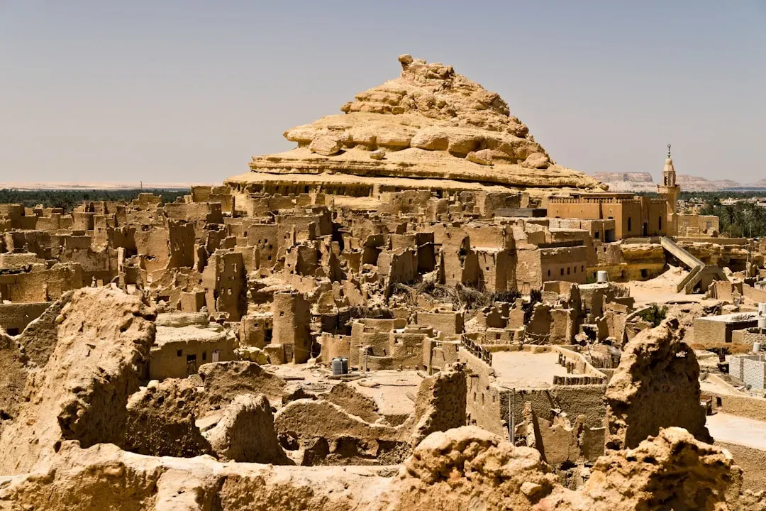
You probably associate Egypt with towering temples and pyramids rising above the desert, but the more surprising story is how much of that ancient world is still hidden just below the surface. Around Luxor and throughout the Nile Valley, archaeologists have been uncovering entire city quarters, industrial districts, and religious complexes that were sealed under layers of sand for thousands of years. In some cases, what you walk past as a “flat, empty” lot is actually the roofline of a buried workshop or courtyard only a meter or two down.
This is especially true near long-occupied zones like ancient Thebes and Memphis, where shifting sands, floods, and modern construction repeatedly buried and reburied earlier phases of occupation. Ground-penetrating radar, magnetometry, and careful excavation have revealed planned streets, storage areas, and ceremonial spaces that flesh out daily life in a way pyramids never could. You start to see Egypt not just as a kingdom of monument builders, but as a patchwork of bustling neighborhoods and sacred sites quietly resting under the same sand tourists crunch across every day.
Ancient Rivers, Lakes, And Green Worlds Now Entombed In Desert
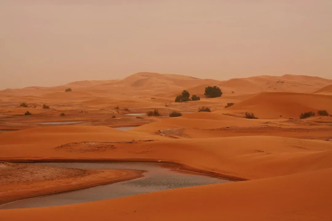
One of the most mind-bending shifts for you comes when you learn that many of today’s deserts were once far greener than you’ve been led to believe. Studies in Arabia and North Africa have mapped ancient lakes, river channels, and even massive valleys now buried under sand sheets. These former waterways acted like arteries, carrying people, animals, and ideas across regions that you currently think of as impassable. In dry satellite images, they show up as faint curving lines and basin shapes; once you know what you’re looking at, you cannot unsee them.
For early humans and later civilizations, these green corridors were lifelines. Stone tools, campsites, and animal bones cluster along the edges of old lakes and riverbeds, revealing long cycles of occupation and abandonment as climates shifted. When you realize that a modern dune sea might sit on top of a landscape once dotted with wetlands and grazing herds, human migration stories start to look very different. Instead of imagining people skirting desert margins, you picture them moving through rich interior worlds that are now sealed off under meters of sand, waiting for geology and technology to bring them back into the narrative.
The New Toolkit: LiDAR, AI, And Non‑Destructive Archaeology
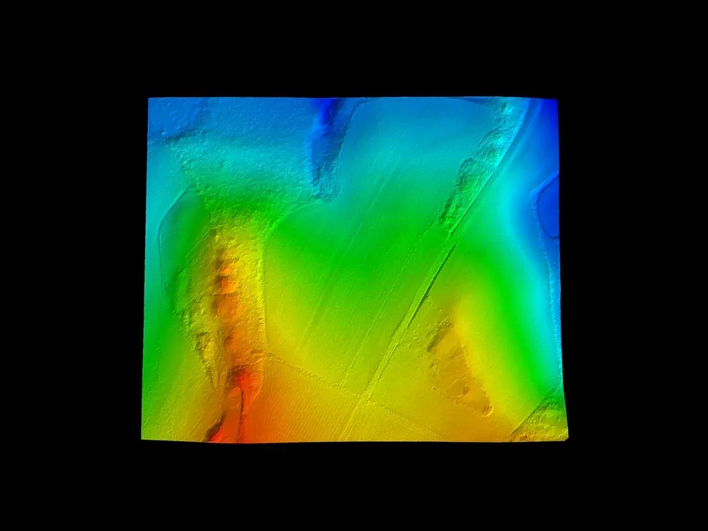
If you used to picture archaeology as a person with a trowel and a brush, you are not wrong – but you are missing the fastest-growing side of the field. Today, archaeologists combine classic excavation with remote sensing tools like LiDAR (which measures distance with pulses of light), ground‑penetrating radar, and high‑resolution satellite imagery. In forested regions, LiDAR strips away digital vegetation to reveal hidden cities; in deserts, radar and multispectral sensors highlight subtle variations in the ground that point to buried walls, roads, and irrigation channels. The beauty of these techniques is that they let you “see” sites before disturbing a single grain of sand.
Once the data is captured, AI and advanced mapping software step in to help you make sense of it all. Algorithms trained on known archaeological sites learn to recognize the geometric signatures of human construction, flagging rectangular compounds, alignments, and road grids across vast landscapes. This combination of non‑destructive surveying and machine analysis not only accelerates discovery, it also gives local communities and governments the chance to protect sites before they are damaged by development, looting, or climate change. Instead of archaeology trailing behind destruction, you watch it slowly move ahead of the bulldozers.
Why These Discoveries Matter To You Today
It is tempting to treat all of this as curiosity – fun headlines about lost cities and mysterious ruins – but the implications reach straight into your present. For one thing, buried rivers and ancient water systems can guide modern decisions about groundwater, agriculture, and settlement planning in arid regions. If you live in or care about desert communities, knowing where people successfully managed water in the past can offer clues for more resilient strategies now. Old caravan routes and oasis networks also show you how trade and cultural exchange flourished under harsh conditions, a reminder that isolation is not destiny, even in extreme climates.
These finds also force you to rethink whose stories get told. When radar and satellites spotlight previously unknown civilizations beneath sands in Arabia, North Africa, or coastal Peru, they broaden the cast of characters in world history. You see that urban planning, complex religion, and long‑distance trade were not confined to a small set of “classic” civilizations taught in Western textbooks. Finally, the very act of discovering these places non‑destructively encourages you to treat the buried past as a shared inheritance rather than a mine to be stripped for artifacts. Each newly mapped street or riverbed quietly asks you what kind of ancestor you want to be for the people who might one day study your own buried world.
When you step back and take all of this in, deserts stop being blank spaces at the edge of your imagination. Under the dunes lies a record of experiments in survival, creativity, and adaptation that mirrors your own struggles, just stretched across thousands of years. The next time you see an image of endless sand, you might find yourself wondering whose footsteps, walls, and waterways are still there, just out of sight. If the deserts you thought you knew can hide entire civilizations, what else in your world might be far less empty than it appears at first glance?