You walk across a familiar beach, a salt flat, or a Midwestern farm field and assume you know what you’re looking at. But just below the surface, entire lost worlds are hiding in plain sight. Prehistoric shorelines, drowned river valleys, vanished lakes, and buried cities of earth and stone lie all around you in the United States, quietly rewriting what you thought you knew about this place.
Once you start looking for them, these hidden landscapes are everywhere: under the waves of the Atlantic shelf, beneath the dunes of New Mexico, sealed inside cave systems, or flattened by modern agriculture. In many cases, you’re walking on top of evidence that stretches back tens of thousands, even hundreds of millions of years. This article takes you on a tour of some of the most striking of these buried worlds – and shows you how to actually see them the next time you’re out on the land.
1. Drowned Coasts: The Submerged Continental Shelves
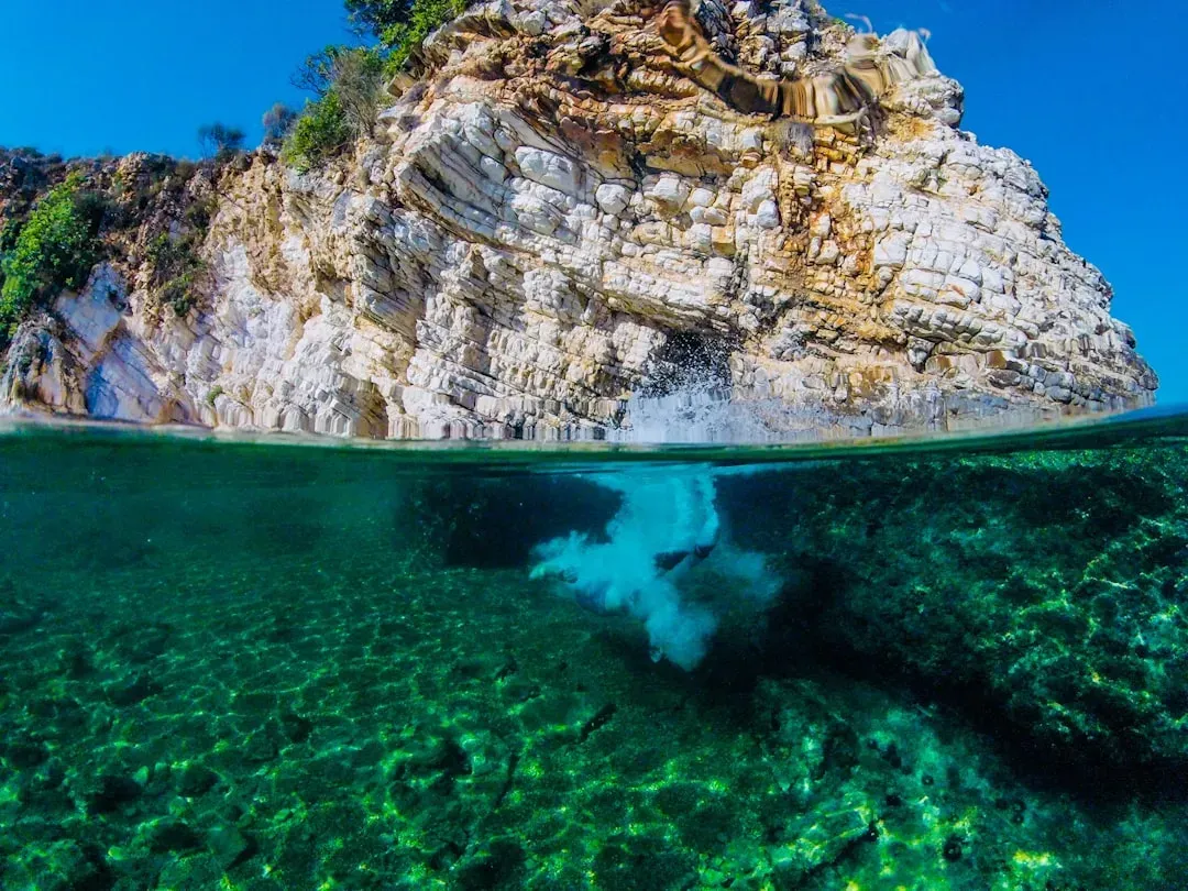
When you stand on a pier along the East Coast, you’re really standing at the edge of a drowned continent. During the last ice age, sea level dropped by hundreds of feet, and what’s now the shallow Atlantic continental shelf was dry land. You would have seen wide river valleys, forests, and coastal plains stretching far beyond today’s shoreline, with rivers like the ancient Susquehanna carving deep channels out across the floor of what is now the Mid-Atlantic Bight.
Today, sonar mapping and sediment cores reveal old riverbeds, estuaries, and former wetlands preserved under the waves, almost like ghost topography. Some researchers suspect that early Americans may have walked, hunted, and camped on those now-submerged plains, leaving sites that are incredibly hard to reach but potentially rich with clues. When you look out at the ocean from the Carolinas, the Gulf of Maine, or Florida, you can imagine an entire hidden landscape out there – a flooded hinterland that once connected coastlines and shaped migration routes.
2. White Sands, New Mexico: Footprints in an Ice Age Lake
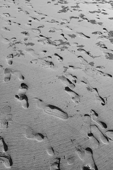
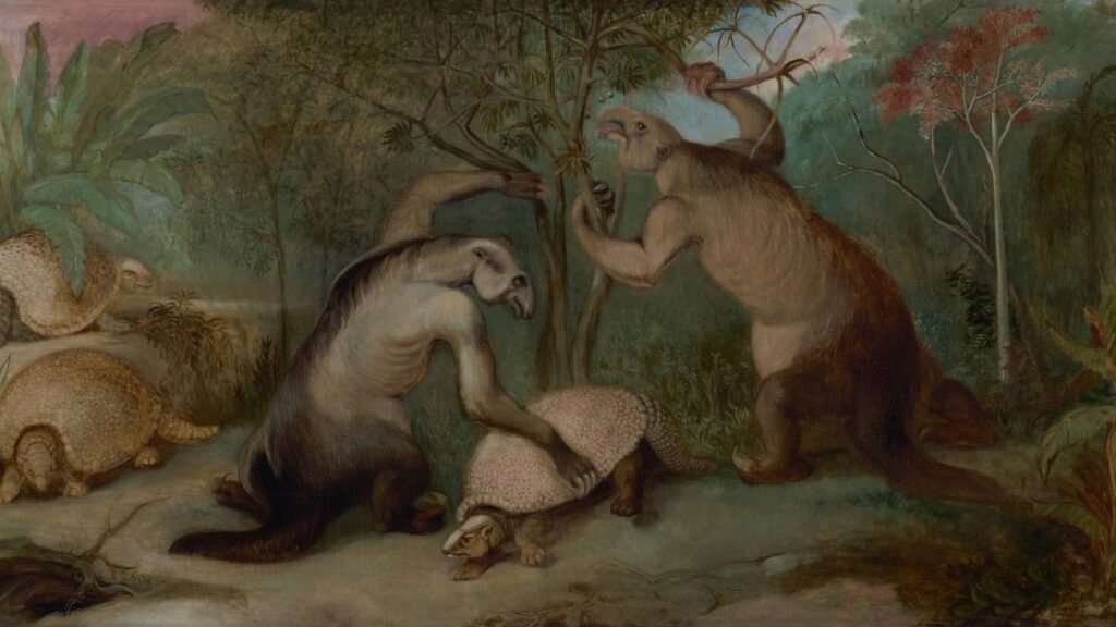
In White Sands National Park, you can look across a blinding white dune field and never guess that an ancient lake once filled that basin. Yet under that shimmering surface, you’re seeing the dry remnant of Lake Otero, a massive ice age lake ringed by wetlands and grasslands. Along its shores, humans and giant animals once trudged through muddy ground, leaving footprints that later hardened, buried, and waited tens of thousands of years for the wind to uncover them again.
Those fossilized tracks, some dated to between roughly twenty-one and twenty-three thousand years ago, have shaken up the story of when people reached the Americas. You can literally trace the paths of teenagers, children, and hunters walking beside or right into the prints of mammoths, giant ground sloths, and other extinct megafauna. When you stand there today, you’re not just visiting dunes – you’re standing inside a frozen scene from the last ice age, where the lake and its marshy edges still exist, just locked in the layers beneath your feet.
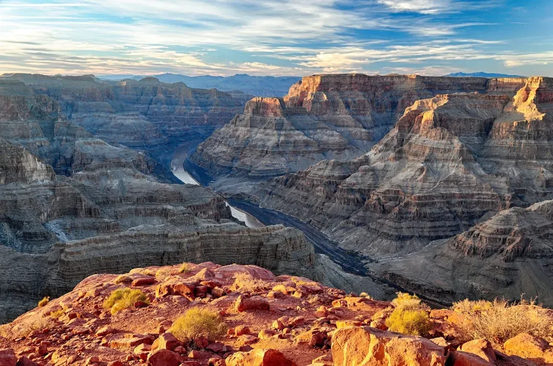
3. The Vanished Rivers and Lakes Beneath the Great Plains
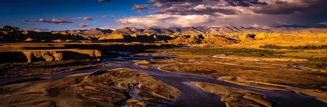
If you’ve ever driven across Kansas, Nebraska, or the Dakotas and thought, “This is just endless flat land,” you’re missing the story underneath. The Great Plains hide a patchwork of ancient river systems and vanished lakes that predate the modern landscape. Long before current rivers like the Platte and Missouri settled into their routes, older, mightier streams carved different paths and later got filled with sediments, leaving buried valleys hundreds of feet below today’s surface.
Geologists map these hidden channels using well logs, seismic surveys, and drilling data, and what they see is a sort of X-ray of the Plains: deep, meandering canyons and former lake basins now packed with younger sediments and groundwater. When you look at a flat farm field, you might actually be above the silent course of an ancient river that once cut through bedrock and carried meltwater from retreating ice sheets. You’re standing on stacked landscapes – a modern prairie perched on top of a drowned, prehistoric drainage system.
4. Hidden Cities of Earth: Cahokia and the Mississippian Heartland
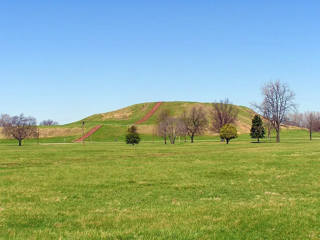
On the floodplain near modern St. Louis, you can climb what looks like a strange, isolated hill called Monks Mound and not realize you’re at the core of a prehistoric city. Cahokia, at its height between about the year 1050 and 1200, was the largest urban center north of Mexico, with a population that may have rivaled or surpassed many European cities of the same era. What you see today – earthen mounds rising from lawns and fields – is only the most visible tip of a massive, largely buried landscape.
Subsurface surveys and excavations reveal plazas, wooden posts aligned with the sun, residential neighborhoods, and smaller mounds now leveled by farming and urban sprawl. When you drive past Midwest subdivisions, highways, and cornfields along the Mississippi, you’re often passing right over the footprints of Mississippian towns and earthworks that shared cultural ties with Cahokia. This prehistoric city-scape is half-erased from view, but once you know it’s there, the whole central U.S. suddenly feels like a layered palimpsest of older urban experiments written beneath your own.
5. Fossil Forests and Buried Swamps Under Modern Shores
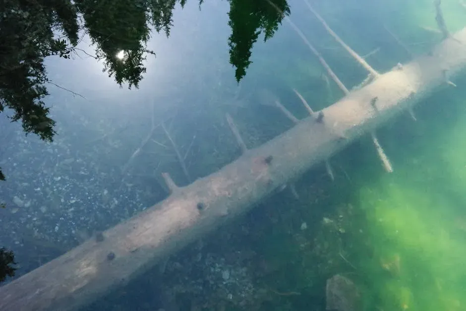
Walk a storm-swept beach in places like the Carolinas or the Gulf Coast after a strong erosion event, and you might stumble across something uncanny: dark stumps, roots, or logs sticking out of the sand, as if an entire forest tried to grow out of the surf. In many of these cases, you’re looking at buried cypress swamps or coastal forests that were alive when sea level was lower. As the shore migrated inland, waves and mud slowly sealed them away, forming peat layers and submerged forests just offshore.
When storms strip away the beach, they briefly reveal this prehistoric shoreline, letting you touch tree trunks that may have been rooted thousands of years ago. Similar hidden wetlands show up in cores taken from beneath modern barrier islands and estuaries, where layers of peat and wood mark the positions of former marshes and lagoons. The coastline you know now is just the latest setting; under it lies a staircase of older shorelines, each with its own forests, floodplains, and wildlife communities.
6. Caves, Karst, and Underground Prehistoric Worlds
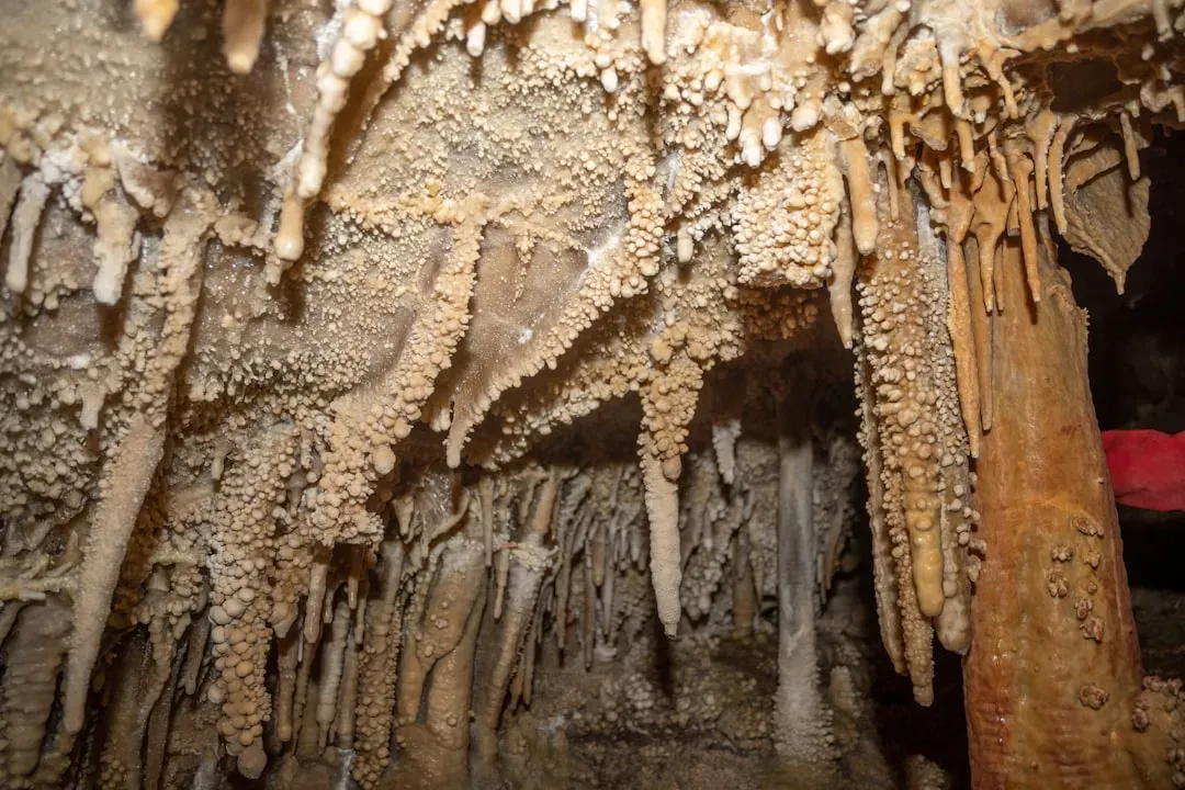
In limestone regions from Kentucky and Tennessee to Missouri and Texas, the real prehistoric landscape is often hidden below you, in cave systems and sinkholes. Over millions of years, water dissolved the rock, carving out underground rivers, chambers, and vertical shafts that later became traps for bones, artifacts, and sediments. When you walk over a karst plain, you might be traveling above a vast hollow space that once held cave bears, giant ground sloths, or some of the earliest people to venture into North America’s interior.
These caves preserve delicate traces that surface environments almost always erase: charcoal from torches, pollen from ancient plants, footprints in soft mud, and carefully buried remains. As you tour a show cave today, you may be only seeing a sanitized slice of a much larger labyrinth still under study by speleologists and archaeologists. To really appreciate the prehistoric U.S., you have to think three-dimensionally: the landscape does not stop at the ground surface; it tunnels downward, holding small, perfectly sealed time capsules that might be older than any monument on land.
7. Ice Age Corridors and Buried Landscapes of the North
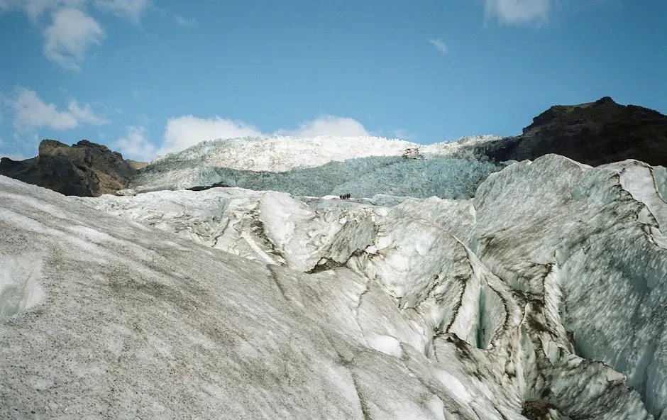
Travel across Alaska, northern Montana, or the Dakotas, and it’s easy to focus on the mountains and forests you can see. But during the last glacial maximum, these regions sat near the edges of massive ice sheets that ground the land, dammed rivers, and flooded valleys. When those ice sheets melted, they created enormous proglacial lakes and spillways, some of which dwarf anything you see today. As those lakes drained and rivers shifted, they left behind buried channels, gravel bars, and lake beds that now hide under soil and vegetation.
Parts of Alaska itself remained ice-free even at the height of the last glaciation, forming a huge steppe region that connected to Siberia. That landscape, sometimes called Beringia, extended across what is now the Bering Sea, and much of it is now submerged. When you look at a modern map, what you are really seeing is the shrunken remnant of a larger landmass that early humans and animals roamed freely. The northern U.S. and Alaska are full of subtle clues – oddly placed boulders, terraces, and buried sediments – that point to this dynamic, vanished ice age world.
8. Reading Your Own Backyard: How to See Hidden Prehistoric Landscapes
Once you know these stories, you can start to spot hints of hidden prehistoric landscapes almost anywhere you go in That low, flat area on a hike might be a former lake bed; a strange line of terraces along a river could mark old flood levels; a cluster of rounded hills in farm country might be glacial debris. You do not need to be a professional geologist or archaeologist to begin asking, “What used to be here before this?” That simple question alone changes how you read the ground under your feet.
If you want to dig deeper, you can look at topographic maps, check out state geological surveys, or read interpretive signs at parks with an eye for deeper time. On your next trip, try visiting places like White Sands, Cahokia, coastal refuges, or cave parks with the mindset that you are stepping into stacked layers of landscapes, not just a single one. Over time, you’ll start to see less as a fixed place and more as a slowly shifting stage set, where rivers move, seas rise, cities rise and fall, and whole worlds are buried but not entirely gone.
Conclusion: Living on Top of Ghost Worlds
When you zoom out in time, the United States stops feeling like a stable backdrop and starts to look like a living, breathing organism that constantly reshapes itself. Under your freeways, farms, suburbs, and favorite national parks, you are sharing space with ice age lakes, drowned coasts, fossil forests, underground caverns, and the remains of massive prehistoric cities. You are not just standing on dirt; you are standing on stacked worlds, each one a different version of this land.
That realization can be strangely humbling and oddly comforting at the same time. It reminds you that change is the rule, not the exception, and that your own moment here is just one thin layer in a very thick book. The next time you look at a flat field, a coastline, or a dry desert basin, ask yourself: if you could peel back the surface, what hidden landscape would you uncover – and would it be anything like what you would have guessed?