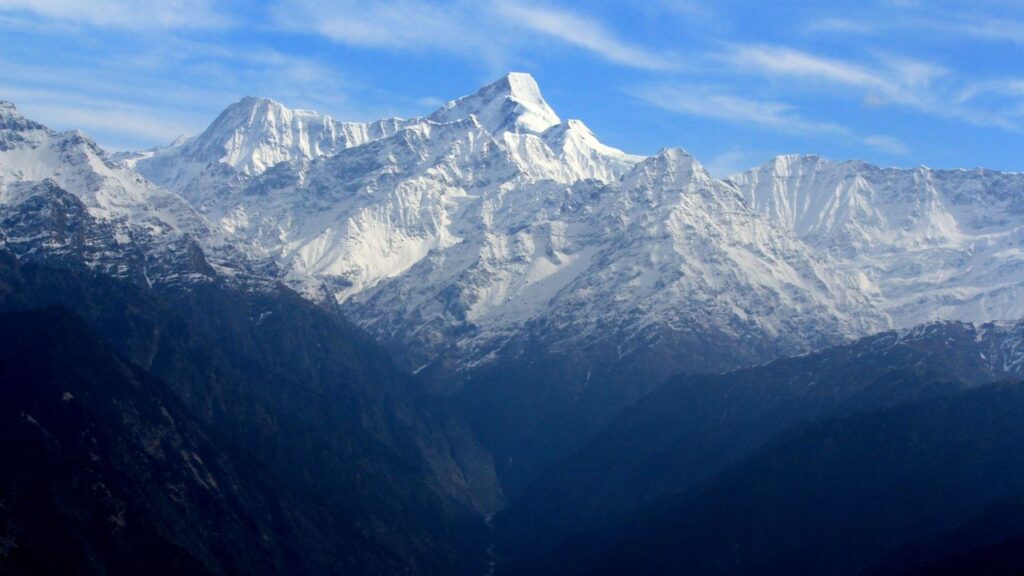
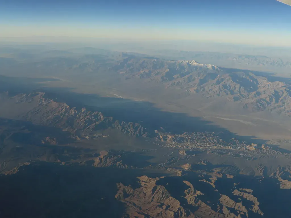
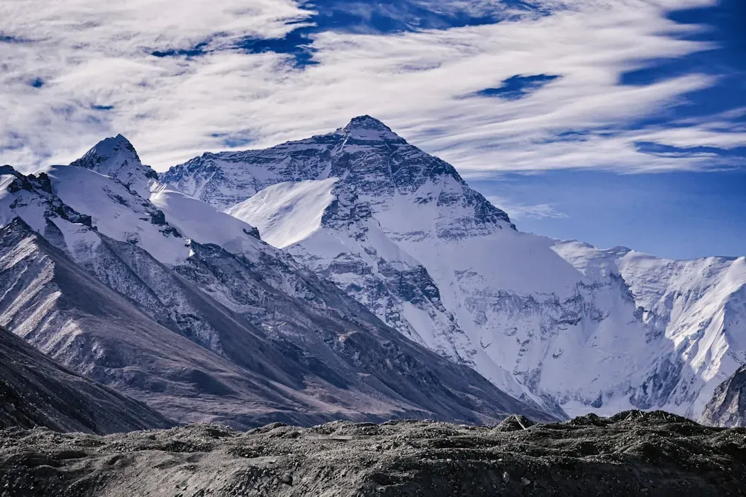
If you stand in front of the Himalayas today, it feels like you’re looking at the roof of the world. But here’s the twist: the height you see now is just one snapshot in a long, dramatic story that’s still unfolding beneath your feet. These mountains haven’t always been this tall, and in some eras of Earth’s past, they may have been even more extreme than they are today.
When you dig into the science behind mountain building, you realize the Himalayas are less like a static wall of rock and more like a living, shifting machine. Over millions of years, they’ve risen, collapsed, eroded, and rebuilt themselves in cycles that make your sense of time feel tiny. As you trace this hidden history, you start to see how much of the Himalayas’ true height is invisible, either worn away or still locked deep underground.
The Collision That Created a Giant
To understand the Himalayas’ secret past, you first need to picture two continents slamming into each other at walking speed. You have the Indian Plate moving north and colliding with the Eurasian Plate, a slow-motion crash that began tens of millions of years ago and still hasn’t finished. As India kept pushing, the crust between them crumpled, thickened, and stacked up, like a rug bunching under a closing door.
What you call “height” at the surface is only the top of that crumpled mass. Deep below the peaks, the crust under the Himalayas is much thicker than normal continental crust, almost like the hidden roots of a tooth buried in your jaw. The visible mountains are just the exposed edge of a huge, swollen block of rock, and that thickness is what allows such extreme elevations to exist at all.
Before Everest: When the Himalayas Were Shorter
When the collision first started, the Himalayas were not instantly the colossal range you see now. You would have seen a rising plateau and growing ridges, but nothing close to Mount Everest piercing the sky. Early mountain belts along the collision zone were probably much lower, more like high hills and modest ranges gradually gaining height as India continued to grind northward.
If you could rewind time tens of millions of years, you’d watch peaks slowly emerge as layers of rock piled and folded on top of each other. The landscape would shift from low coastal plains and shallow seas into an elevated interior, with rivers starting to carve valleys into the new terrain. The Himalayas you know today are the result of that long, patient buildup, not a single dramatic event.
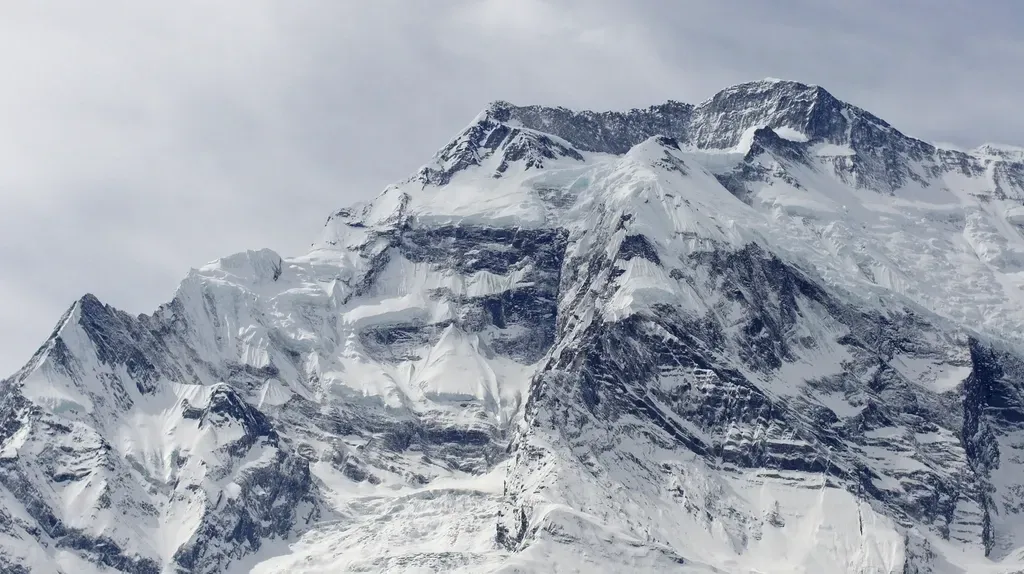
Higher Than Today? The Hidden Story of Lost Elevation
Here’s where things get really intriguing: there’s a good chance some parts of the Himalayas reached their maximum heights in the past and have since been cut down by erosion. You might be looking at peaks that, in an earlier era, stood even taller before wind, ice, and rivers began slicing them back down. When erosion is intense and uplift continues, you get a tug-of-war where height can stabilize or even decrease, even though the crust is still being thickened below.
You see the clues in the deep, V-shaped valleys, the hanging glaciers, and the enormous debris fans at the foot of the range. These are signs that huge volumes of rock have already been stripped away. As climate shifts brought stronger monsoons, more rainfall, and more glaciation, erosion likely accelerated, shaving off the most fragile, oversteepened parts of the peaks. So when you imagine their “true” maximum heights, you have to factor in the mountain that’s already been turned into sand, silt, and mud and carried far downstream.
The Tibetan Plateau: A High Plain That Tells on the Peaks
If you really want to sense the Himalayas’ vertical story, you can’t just stare at the famous summits; you also have to look north to the Tibetan Plateau. This vast, high plain sits at an altitude that rivals many mountain ranges by itself, and it rose along with the Himalayas as the Indian Plate drove under Asia. When you walk across that plateau, you’re basically walking on evidence that the entire region was pushed upward, not just a narrow line of peaks.
Scientists study ancient sediments, fossil plant leaves, and oxygen isotopes in rocks from Tibet to estimate how high the land stood at different times. From this, you get a picture of a once-lower plateau that gradually inflated as the crust thickened and heated from below. That broad uplift supports the idea that some parts of the system, including nearby peaks, have gone through phases of maximum elevation followed by periods where erosion and crustal flow softened the extremes.
Measuring Old Heights: How You Read a Mountain’s Diary
You can’t travel back in time with a GPS, so to figure out past heights, you rely on the rocks themselves as record keepers. When you see certain fossils, like plant species that prefer warm, low-elevation environments, sitting today at several kilometers above sea level, that tells you the land was once lower when those plants lived there. On the flip side, specific chemical signatures in minerals can reveal cooler, thinner-air conditions that match higher elevations in the past.
You also look at how minerals cooled over time deep within the crust, using techniques that act like geological thermometers and clocks. As rock is eroded from above, deeper levels move closer to the surface and cool, leaving behind a temperature-time path. By reading that path, you can reconstruct when rocks rose toward the surface and how quickly they were exhumed, giving you clues about both uplift and erosion, and letting you infer how tall the overlying mountains likely were.
Still Rising: The Himalayas’ Present Is Not Their Final Form
Despite all the erosion at the surface, the Himalayas are still growing overall, and you can actually measure it today. Modern GPS networks show that many parts of the range are still being pushed upward by a few millimeters each year as India continues to press into Eurasia. If you stand on a Himalayan ridge now, you’re standing on a moving platform that’s quietly shifting and rising without asking your permission.
That uplift does not necessarily mean the visible peaks will keep getting taller forever, though. As height increases, slopes become steeper, glaciers grow heavier, and rockfalls become more frequent, which all ramp up erosion. You end up with a kind of rough balance where uplift feeds growth from below and erosion trims from above, so the mountains hover around a dynamic equilibrium. The “true height” is really a moving target shaped by that ongoing push-and-pull.
Climate, Monsoons, and the Sculpting of the Summits
You might think of tectonics as the only player in this story, but climate is just as powerful when it comes to real-world mountain heights. The South Asian monsoon system brings tremendous seasonal rainfall that scours slopes, triggers landslides, and fuels rivers that cut deeply into the range. In the highest zones, ice and snow turn into glaciers that grind rock like massive conveyor belts, transporting debris downslope and carving valleys that bite into the mountain’s core.
Because the Himalayas themselves help shape regional climate, you get a feedback loop. As the range rose and blocked atmospheric flow, it strengthened the monsoon, which then increased erosion and altered how quickly the peaks could grow. In some areas, intense erosion may have actually driven more uplift by removing weight from the crust, allowing it to rebound upward. So the “secret past” of their heights is tied not only to the slow collision of continents but also to storms, ice, and rivers constantly carving away at what tectonics builds.
What the Himalayas’ Past Heights Mean for You Today
When you think about how the Himalayas may have once been even more extreme than they are now, it changes how you see the present landscape. Every cliff, gorge, and jagged skyline becomes a reminder that you’re only catching one phase of a much longer story. The villages on narrow terraces, the roads clinging to unstable slopes, and the sacred peaks in local traditions all sit on a stage that has been rising and collapsing for millions of years.
It also reminds you that what feels solid and eternal in your lifetime is, on geological timescales, more like a wave cresting and breaking. The same forces that built these heights are still active and will keep reshaping the region long after you’re gone. Understanding that bigger picture gives you a deeper respect not just for the danger of earthquakes and landslides, but also for the sheer patience of Earth in building something this monumental.
In the end, the Himalayas’ secret past is a story of constant negotiation between uplift, erosion, and climate, with their true heights rising and falling through deep time. When you look up at Everest or any other Himalayan giant, you’re not seeing a finished sculpture, but a work in progress that has already worn away parts of its own greatest achievements. That realization can be strangely comforting: even the highest mountains are changing, adapting, and responding to forces larger than themselves. Next time you see a photo of those legendary peaks, will you picture the invisible mountains that once stood even higher above the clouds?